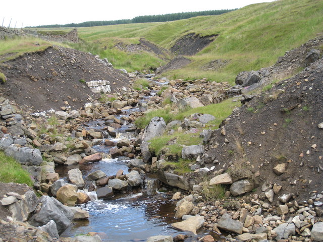
Garrigill Burn near Bentyfield Mine (view east)

-
Description
"This photograph of Garrigill Burn was taken looking upstream in a westerly direction towards Nunnery Hill. From here, the stream runs downhill in a south-westerly direction to join the River South Tyne just west of the village of Garrigill." Photo by Philip Barker, 2009. -
Owner
Philip Barker -
Source
Geograph (Geograph) -
License
What does this mean? Creative Commons License
-
Further information
Link: http://www.geograph.org.uk/photo/1605595
Resource type: Image
Added by: Simon Cotterill
Last modified: 7 years, 4 months ago
Viewed: 790 times
Picture Taken: 2009-07-12 -
Co-Curate tags


