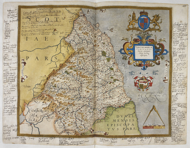
Lord Burghley's Atlas - caption: 'Engraved map of Northumberland, from drawings of Christopher Saxton. Dedicated to Queen Elizabeth I. With annotations in the hand of Lord Burghley.'
-
Description
http://britishlibrary.georeferencer.com/id/12459607684" rel="noreferrer nofollow">Go to BL Georeferencer to Place this map or View an overlay ID: https://imagesonline.bl.uk/?service=search&action=do_quick_search&language=en&q=royal_ms_18 D III_f072r" rel="noreferrer nofollow">royal_ms_18 D III_f072r Title: Lord Burghley's Atlas Illustrator: "Saxton, Christopher (Christopher Saxton)" Provenance: London; 1579 Caption: Engraved map of Northumberland, from drawings of Christopher Saxton. Dedicated to Queen Elizabeth I. With annotations in the hand of Lord Burghley. Language: English Source identifier: Royal 18 D. III, ff.71v-72 British Library Shelfmark: Royal 18 D. III If you wish to purchase a high quality copy of this image, please place an order at Images Online http://imagesonline.bl.uk" rel="noreferrer nofollow">imagesonline.bl.uk. The details from the above list should help you locate the images. -
Owner
The British Library -
Source
Flickr (Flickr) -
License
What does this mean? No known copyright restrictions -
Further information
Link: https://www.flickr.com/photos/12403504@N02/12459607684/
Resource type: Image
Added by: Simon Cotterill
Last modified: 7 years, 1 month ago
Viewed: 1553 times
Picture Taken: 2014-02-11T14:58:07 -
Co-Curate tags


