Topics > County Durham > Civil Parishes in County Durham > Muggleswick Civil Parish > Muggleswick historical description, 1890
Muggleswick historical description, 1890
Extract from: Kelly's Directory of Durham, 1890
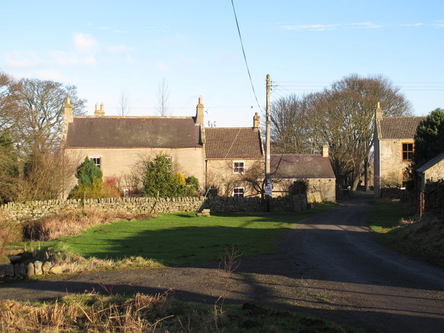
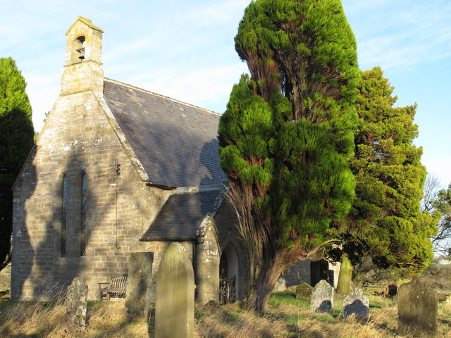
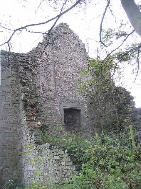
MUGGLESWICK is a parish, about 20 miles south-west from Newcastle by road and nearly the same distance northwest from Durham, and 9 north from Stanhope station on the Consett and Darlington section of the North Western railway, in the North Western division of the county, west division of Chester ward, petty sessional division and union of Lanchester, county court district of Shotley Bridge, rural deanery of Stanhope, officialty of the Dean and Chapter of Durham, archdeaconry of Auckland and diocese of Durham. The place was noticed in records of Bishop Pudsey’s time, who granted it to the convent of Durham in exchange for Hardwick: in the 13th century the prior of Durham had a park here, and there are still some slight remains of a residence or castle, as well as of the fishpond. The river Derwent flows through this township, in one part in a deep and singularly contorted ravine, clothed with oak, birch and firs; but the southern portion of the parish, stretching westward, is a region of rough hills and moors, rich in minerals, but having a very rugged aspect. Rowley and part of Castleside are in this parish. The village of Muggleswick contains only three farms and a few cottages. The church (name not known), is a small building of stone, consisting of chancel, nave, south porch and a turret containing one bell, and was rebuilt in 1869, on the site of the former church: there are 200 sittings. The register dates from the year 1730. The living is a vicarage, tithe rent-charge £34, net yearly value £300, including glebe, with residence, in the gift of the Dean and Chapter of Durham, and held since 1855 by the Rev. James John Cundill B.A. of St. John’s College, Cambridge. The Dean and Chapter of Durham are lords of the manor and the Ecclesiastical Commissioners and the vicar of Muggleswick the chief landowners. The soil is clay, peat and sandy loam; subsoil, sandstone. The crops are wheat, barley, oats, potatoes and turnips, and there are extensive sheep pastures. The acreage is 7,098; rateable value, £3,818; the population in 1881 was 841.
Parochial School (mixed), built in 1852, for 50 children, average attendance, 20.

Co-Curate Page
Muggleswick
- Overview About Muggleswick Map Street View Muggleswick is remote settlement on the edge of the North Pennines Moors, located about 4 miles west of Consett in County Durham. It is …

Co-Curate Page
Church of All Saints, Muggleswick
- Overview Map Street View A church was first built here in 1259 after the priors of Durham had a retreat grange built at Muddleswick under Prior Hugh of Darlington. The …

Co-Curate Page
Muggleswick Parish, 1848
- MUGGLESWICK, a parish, in the union of Lanchester W. division of Chester ward, N. division of the county of Durham, 14 miles (S.W.) from Gateshead; containing 421 inhabitants. This place, …


Co-Curate Page
Muggleswick
- Overview About Muggleswick Map Street View Muggleswick is remote settlement on the edge of the North Pennines Moors, located about 4 miles west of Consett in County Durham. It is …

Co-Curate Page
Church of All Saints, Muggleswick
- Overview Map Street View A church was first built here in 1259 after the priors of Durham had a retreat grange built at Muddleswick under Prior Hugh of Darlington. The …


