Topics > Northumberland > Walwick Grange > Medieval Cross, south of Walwick Grange
Medieval Cross, south of Walwick Grange
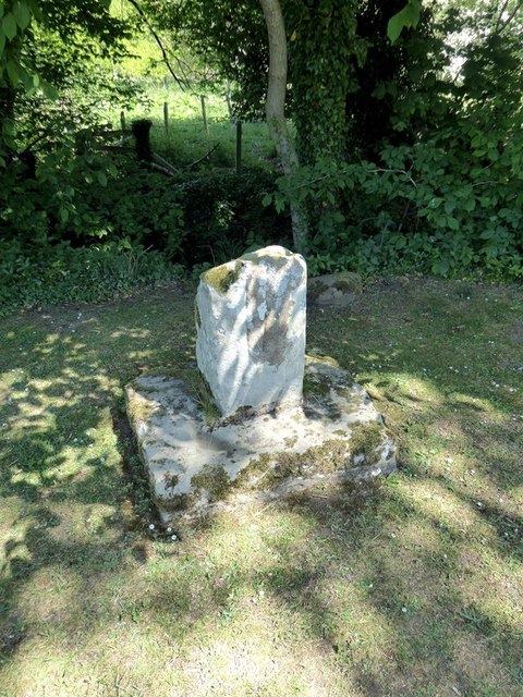
The substantive remains of a Medieval wayside cross are located on Homer's Lane, a minor road which runs along the west banks of the River North Tyne, connecting Warden to Walwick and Stanegate (the route of the Roman road). The lane is now part of National Cycle Route 72. The cross is located just under ½mile south of Walwick Grange. The cross is a Scheduled Monument. Despite the loss of its upper shaft and is a good example of a wayside cross in Northumberland.

from Geograph (geograph)
Remains of medieval cross south of Walwick Grange
Pinned by Simon Cotterill


from Geograph (geograph)
Remains of medieval cross south of Walwick Grange
Pinned by Simon Cotterill

from https://historicengland.org.u…
Medieval wayside cross, 780m SSE of Walwick Grange - List Entry
- ....A medieval cross is situated just above the west bank of the River North Tyne immediately east of the Stanegate, the Roman road from Corbridge to Carlisle. The cross is …
Added by
Simon Cotterill

from Geograph (geograph)
Remains of medieval cross south of Walwick Grange
Pinned by Simon Cotterill
from Geograph (geograph)
Remains of medieval cross south of Walwick Grange
Pinned by Simon Cotterill
from https://historicengland.org.u…
Medieval wayside cross, 780m SSE of Walwick Grange - List Entry
- ....A medieval cross is situated just above the west bank of the River North Tyne immediately east of the Stanegate, the Roman road from Corbridge to Carlisle. The cross is …
Added by
Simon Cotterill


