Topics > Northumberland > Wooler > Map and Aerial View
Co-Curate Page
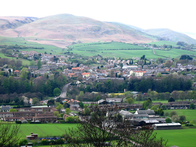
Wooler
- Overview About Wooler Timeline Map Street View Wooler is an historic market town and parish in Northumberland, situated on the edge of the Northumberland National Park, and the Cheviot Hills. …

from https://britainfromabove.org.…
EPW040660 ENGLAND (1932). The village and Wooler Water, Wooler, from the south-east, 1932
- Image c/o Britainfromabove.org.uk (Historic England) available under terms and conditions: https://britainfromabove.org.uk/en/legalities (Display Attribution [no cropping of watermark]. Include link to source page. No Commercial Use or Sale, No Sub-Licensing, no …
Added by
Peter Smith

Co-Curate Page
Wooler
- Overview About Wooler Timeline Map Street View Wooler is an historic market town and parish in Northumberland, situated on the edge of the Northumberland National Park, and the Cheviot Hills. …
from https://britainfromabove.org.…
EPW040660 ENGLAND (1932). The village and Wooler Water, Wooler, from the south-east, 1932
- Image c/o Britainfromabove.org.uk (Historic England) available under terms and conditions: https://britainfromabove.org.uk/en/legalities (Display Attribution [no cropping of watermark]. Include link to source page. No Commercial Use or Sale, No Sub-Licensing, no …
Added by
Peter Smith

")


