Topics > Civil Parishes in Cumbria > Asby Civil Parish > Historic Buildings and Monuments in Asby Civil Parish
Historic Buildings and Monuments in Asby Civil Parish
Listed buildings and scheduled monuments in Asby Civil Parish, Cumbriafrom the National Heritage List for England[1]. Use the Search (below) if looking for a specific building / monument.
| Structure | List No. | Grade | Built~ | Notes |
|---|---|---|---|---|
| Asby Hall, Area Railings and Central Gate | 1144927 | II* | ||
| Barn Range to North West of Asby Hall | 1326995 | II | ||
| Barn to East of Grange Hall | 1137188 | II | ||
| Barn to South East of Fell View Farmhouse | 1144933 | II | ||
| Byre Range to North East of Asby Hall | 1144928 | II | ||
| Byre/Barn to South East of Asby Hall | 1144929 | II | ||
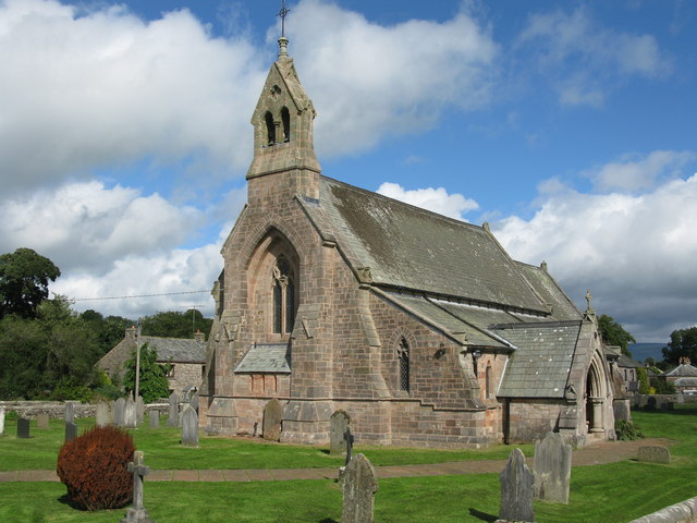
| Church of St Peter | 1144926 | II | 1866 | Great Asby |
| Elm Tree Old Farmhouse and Attached Byre | 1144930 | II | ||
| Farmhouse at Whygill Head (Known As High Whygill) and Adjacent Barn | 1326999 | II | ||
| Farmhouse at Whygill Head (Known As Low Whygill) and Adj Barn | 1312435 | II | ||
| Fell View Farmhouse and Adjoining Buildings | 1312425 | II | ||
| Footbridge over Dale Beck West of Roadbridge | 1326997 | II | ||
| Forecourt Wall, Railings and Stone Gateposts to North of Asby Hall | 1326994 | II | ||
| Gaythorne Hall | 1137181 | II* | ||
| Grange Hall and Adjoining Buildings | 1326998 | I | ||
| Lych Gate to West of Church of St Peter | 1326993 | II | ||
| Old Rectory | 1326996 | II* | ||
| Roadbridge over Potts Beck at Water Houses | 1144935 | II | ||
| St Helen's Well to South of St Helen's Almshouses | 1137163 | II | ||
| St Helens Almshouses | 1144932 | II | ||
| Town End Farm | 1456044 | II | ||
| Well to East of Grange Hall | 1144934 | II* | ||
| White House | 1144931 | II | ||
| Bowl barrow on Asby Mask | 1011156 | n/a | Scheduled Monument | |
| Earthworks at Little Asby | 1007217 | n/a | Scheduled Monument | |
| Round cairn 450m north-east of Mazon Wath | 1011155 | n/a | Scheduled Monument | |
| Castle Folds Romano-British defended stone hut circle settlement and medieval shieling | 1011141 | n/a | Scheduled Monument | |
| Romano-British enclosed hut circle settlement 350m WNW of Maisongill | 1011139 | n/a | Scheduled Monument | |
| Romano-British enclosed settlement on Holborn Hill | 1011140 | n/a | Scheduled Monument | |
| Bowl barrow 60m south-west of Gaythorne Hall | 1011151 | n/a | Scheduled Monument | |
| Hollin Stump round cairn | 1011152 | n/a | Scheduled Monument | |
| Round cairn 490m ENE of Grange Hall | 1011154 | n/a | Scheduled Monument | |
| Water Houses clapper bridge | 1007258 | n/a | Scheduled Monument |
Primary source: the National Heritage List for England - NHLE is the register of nationally protected historic buildings and sites in England, including listed buildings, scheduled monuments, protected wrecks, registered parks and gardens, and battlefields. The list is maintained by Historic England. Check NHLE for updates and new entries.
Secondary sources: British Listed Buildings.


