Topics > Northumberland > Rugley, Denwick > Limekiln west of Old Rugley
Limekiln west of Old Rugley
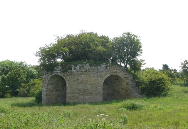
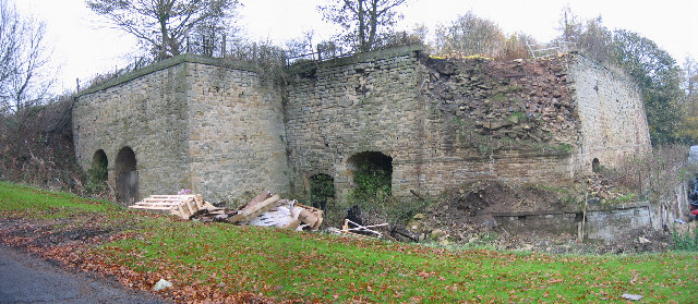
This old limekiln is located on Alnwick Moor between Old Rugley and Hadwin's Close. A disused quarry (presumably limestone) is shown nearby on OS maps. The limekiln dates from the early 19th century and has 3 tall round-headed drawing arches. The limekiln is Grade II listed on the National Heritage List for England.


from https://historicengland.org.u…
LIMEKILN 100 METRES SOUTH OF ROAD 650 METRES WEST OF OLD RUGLEY - Denwick - List Entry
- Limekiln, early C19. Rubble with cut dressings. Extended semicircle plan, with short wing walls revetting flanks of charging ramp to south-east. 3 tall round-headed drawing arches; low segmental arches to …
Added by
Simon Cotterill


List number: 1052367
List grade: 2
Keys to the Past HER: N4536
County: Northumberland
Grid ref: NU1609810154
List grade: 2
Keys to the Past HER: N4536
County: Northumberland
Grid ref: NU1609810154


