Topics > Civil Parishes in Cumbria > Kirkoswald Civil Parish > Kirkoswald Parish, 1848
Kirkoswald Parish, 1848
KIRK-OSWALD (St. Oswald), a market-town and parish, in the union of Penrith, Leath ward, E. division of Cumberland; containing, with the township of Staffield, 948 inhabitants, of whom 691 are in the town, 15½ miles (S.E.) from Carlisle, and 292 (N.N.W.) from London. This place, which derived its name from St. Oswald, the canonized king of Northumbria, was in 1314 burnt by the Scottish army. A collegiate establishment was founded in the church by Rowland Threlkeld, in 1523; at the Dissolution it possessed a revenue of £78. 17. The estates were granted by Elizabeth to the Dodding family, and subsequently to the Featherstonhaughs, of Northumberland, who have been settled here since the time of James I., and whose mansion, called The College, is a venerable structure, formerly the residence of the provost and fellows of the college. It is romantically situated on a gentle eminence rising from the margin of the Raven beck, at a short distance from the town; and retains its ancient oriel window, and other interesting details of its original style. The mansion was plundered by the parliamentarian forces; and there is still preserved the copy of a petition presented to the parliament by the widow of Sir Timothy Featherstonhaugh, in which the loss is estimated at £10,000.
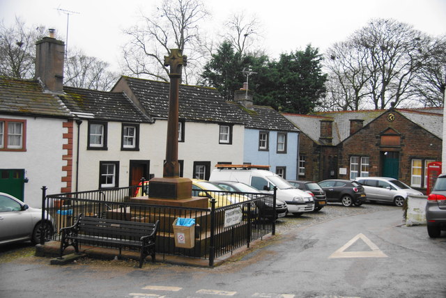
The town is seated on the east of the river Eden, over which a bridge of six arches was erected in 1762, and in a beautiful and fertile vale, inclosed by sloping hills, on whose acclivities the houses are neatly but irregularly built. The Raven beck, over which is a bridge of one arch, intersects the town; and the inhabitants are supplied with water from a reservoir at the market-cross. Kirk-Oswald Castle, situated on a bold eminence about a quarter of a mile to the east of the town, was demolished by the Howards, who removed the furniture and the relics of antiquity which it contained to their castle of Naworth; the ruins, consisting only of one square tower and some dark vaults, have a romantic appearance, and are surrounded on all sides, except that which overlooks the Eden, by a deep fosse. The market, granted in the 2nd year of the reign of King John, is on Thursday, and on Monday is a market for corn, established a few years since; the corn is pitched in the market-place. The fairs are on the Thursday before Whitsuntide, and August 5th, for cattle. The living is a discharged vicarage, valued in the king's books at £8, and in the patronage of the Crown; net income, £120; impropriator, T. Featherstonhaugh, Esq. The church, situated on the slope of an eminence to the south of the town, is an ancient structure in the early English style, with later additions, which were, perhaps, introduced on its enlargement, when made collegiate, in 1523; the tower is detached from the church, and on the summit of the eminence. There are several monuments to the Featherstonhaugh family, among which is one of marble to Sir Timothy, who, for his attachment to the royal cause, was beheaded at Chester, in 1651. Some beautiful stained glass, recently put up, embellishes the windows. The west window, which is lancet-shaped, is divided into two compartments, containing, beneath a decorated canopy, figures of St. Peter and St. Paul; the eastern window is divided into six compartments, the centre representing the Crucifixion, the others the Four Evangelists, St. Oswald, and St. Cuthbert. In the side windows are depicted the arms of the nobility and gentry who are or have been resident, or who have held possessions, in the district. There are a place of worship for Wesleyans in the town, and one for Independents at Park-head, near the eastern extremity of the parish. On the side of a hill, in a field about one mile from the town, are two cairns of moderate size.
Extract from: A Topographical Dictionary of England comprising the several counties, cities, boroughs, corporate and market towns, parishes, and townships..... 7th Edition, by Samuel Lewis, London, 1848.
Co-Curate Page
Kirkoswald
- Overview About Kirkoswald Map Street View The village, civil parish and former market town of Kirkoswald lies in the Lower Eden Valley of Cumbria, formerly Cumberland, about 9 miles …

from https://www.cumbriacountyhist…
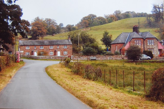
Kirkoswald Township
- "Township in Kirkoswald parish, Leath Ward, Cumberland. CP enlarged by absorbing Renwick and Staffield CPs 1934....farming; charter for market and fair granted 1201: in 17th century weekly market held on …
Added by
Edmund Anon
from https://www.cumbriacountyhist…
Staffield Township
- "Township in Kirkoswald parish, Leath ward, Cumberland. Absorbed into Kirkoswald CP 1934....manor of Staffield held by Thomas de Moulton of Gilsland by c.1300, passing to Dacres and descending with manor …
Added by
Simon Cotterill
Co-Curate Page
Staffield
- Overview Map Street View Staffield is a hamlet in the Eden district of Cumbria. Historically, Staffield was a township in the ancient parish of Kirkoswald in the old County of …

Co-Curate Page
Kirkoswald
- Overview About Kirkoswald Map Street View The village, civil parish and former market town of Kirkoswald lies in the Lower Eden Valley of Cumbria, formerly Cumberland, about 9 miles …
from https://www.cumbriacountyhist…
Kirkoswald Township
- "Township in Kirkoswald parish, Leath Ward, Cumberland. CP enlarged by absorbing Renwick and Staffield CPs 1934....farming; charter for market and fair granted 1201: in 17th century weekly market held on …
Added by
Edmund Anon
from https://www.cumbriacountyhist…
Staffield Township
- "Township in Kirkoswald parish, Leath ward, Cumberland. Absorbed into Kirkoswald CP 1934....manor of Staffield held by Thomas de Moulton of Gilsland by c.1300, passing to Dacres and descending with manor …
Added by
Simon Cotterill


