Topics > Tyne and Wear > Sunderland > Hetton-le-Hole > Hetton-le-Hole Township, 1848
Hetton-le-Hole Township, 1848
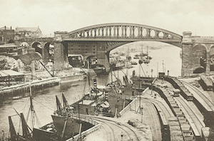
HETTON-LE-HOLE, a township and chapelry, in the parish and union of Houghton-Le-Spring, N. division of Easington ward and of the county of Durham, 2 miles (S.) from Houghton-le-Spring; the township containing 4,158 inhabitants. The chapelry comprises 2,530 acres, of which 1,315 are arable, 993 meadow and pasture, and 222 wood; of the whole, 1598 acres are in the township: the surface is undulated, and the soil a light loam. It includes the populous hamlets of Hetton proper, Easington-Lane, Downs, and Great and Little Eppleton; and is a mining district, with three extensive collieries in full operation. Hetton colliery, one of the most considerable in the kingdom, was commenced in 1822, and its produce, which is of the first quality, is sent almost entirely to the London market; 500,886 tons have been raised in a year, and as many as 2,000 persons have been employed at one time in the colliery and on the works connected with it: the proprietors have a private railway, by which the coal is conveyed to the river Wear at Sunderland. The Durham and Sunderland railway has a station here. There are three quarries, the stone of which is used for building, or burned into lime; and two corn-mills, one worked by steam, and the other by water. The village is pleasantly situated in a vale, about two miles distant from the Durham and Sunderland road, and is a polling-place for the northern division of the county. The chapel, which is in the later English style, with a campanile turret, was erected in 1832, at an expense of £1406, defrayed by subscription; it contains 500 sittings, of which 375 are free. On the late avoidance of the living of Houghtonle-Spring, the chapelry was endowed with the tithes of the district, commuted for £208. There are places of worship for Baptists, Kilhamites, Presbyterians, and Primitive and Wesleyan Methodists. In a field on the right side of the road from Great Eppleton to Hetton, is a tumulus, consisting of a collection of small stones, at the top of which is a cavity, called the Fairies' cradle.
Extract from: A Topographical Dictionary of England comprising the several counties, cities, boroughs, corporate and market towns, parishes, and townships..... 7th Edition, by Samuel Lewis, London, 1848.

from https://openlibrary.org/books…
A topographical dictionary of England, Samuel Lewis, 7th Ed., 1848
- A topographical dictionary of England
comprising the several counties, cities, boroughs, corporate and market towns, parishes, and townships, and the islands of Guernsey, Jersey, and Man, with historical and statistical …
Added by
Simon Cotterill


