Topics > Civil Parishes in Cumbria > Yanwath and Eamont Bridge Civil Parish > Historic Buildings and Monuments in Yanwath and Eamont Bridge CP
Historic Buildings and Monuments in Yanwath and Eamont Bridge CP
Listed buildings and scheduled monuments in Yanwath and Eamont Bridge Civil Parish, Cumbria, from the National Heritage List for England[1]. Use the Search (below) if looking for a specific building / monument.
| Structure | List No. | Grade | Built~ | Note |
|---|---|---|---|---|
| Barn North of the Cottage, on East Side of Courtyard | 1145304 | II | ||
| Barns East of Yanwath Hall | 1373883 | II | ||
| Boer War Memorial, Eamont Bridge | 1412122 | II | ||
| Bridge End | 1049124 | II | ||
| Courtyard Range Adjoining Yanwath Hall | 1145305 | I | C15th | |
| Crown Hotel | 1049100 | II | ||
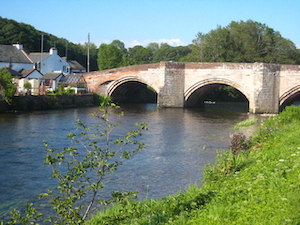
| Eamont Bridge | 1145301 | I | C15th | Partly in this parish. Bridge over River Eamont. |
| Hugh's Crag Viaduct | 1145360 | II | ||
| Lowther Lodge | 1145302 | II | ||
| Lowther Castle - Grounds | 1000668 | II | Partly in this parish. Listed Park and Garden. | |
| Mansion House | 1326789 | II* | ||
| The Cottage | 1049078 | II | ||
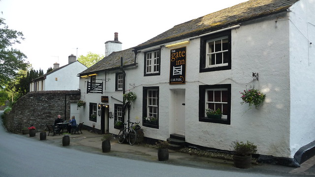
| The Gate Inn | 1145303 | II | 1683 | Yanwath |
| Walls, Gate Piers and Railings Adjoining Lowther Lodge | 1049110 | II | ||
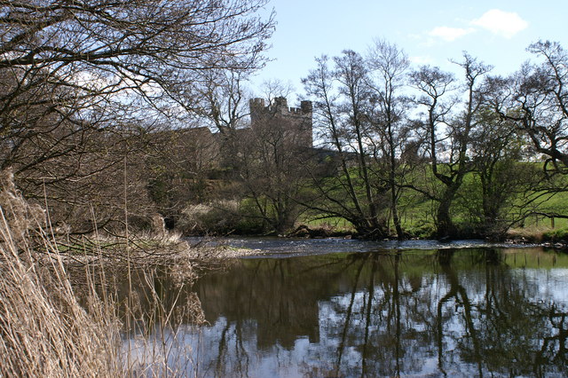
| Yanwath Hall | 1049080 | I | C14th | Fortified house |
| Yanwath Woodhouse | 1145306 | II | ||
| Bowl barrow 850m WSW of Yanwath Woodhouse Farm | 1008235 | n/a | Scheduled Monument | |
| Romano-British settlement and regular aggregate field system north of Yanwath Wood | 1008238 | n/a | Scheduled Monument | |
| Castlesteads multivallate prehistoric defended enclosure | 1008236 | n/a | Scheduled Monument | |
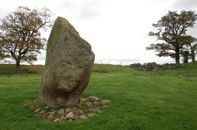
| Mayburgh Henge | 1007902 | n/a | Neolithic | Scheduled Monument |
| King Arthur's Round Table henge | 1007903 | n/a | Neolithic | Scheduled Monument |
| Little Round Table henge | 1008237 | n/a | Scheduled Monument | |
| Eamont Bridge | 1007193 | n/a | C15th | Scheduled Monument |
Primary source: the National Heritage List for England - NHLE is the register of nationally protected historic buildings and sites in England, including listed buildings, scheduled monuments, protected wrecks, registered parks and gardens, and battlefields. The list is maintained by Historic England. Check NHLE for updates and new entries. Secondary sources: British Listed Buildings.
Co-Curate Page
Eamont Bridge (bridge)
- Overview About Eamont Bridge Map Street View The sandstone bridge over the River Eamont at Eamont Bridge (village) dates from the c.15th century. The bridge crossed the old county boundary …
Co-Curate Page
Yanwath Hall
- Overview Map Street View Yanwath Hall and farm is situated by the River Eamont to the north of the village of Yanwath in Cumbria. The hall incorporates a 14th century fortified …
Co-Curate Page
The Gate Inn, Yanwath
- Overview Map Street View The Gate Inn (aka 'The Yanwath Gate') is a public house and resturant in at Yanwath. The pub was originally two seperate houses, which were altered …
Co-Curate Page
Mayburgh Henge
- Overview About Mayburgh Henge Map Street View Henges are ritual or ceremonial sites which date to the Late Neolithic period (2800-2000 BC). Mayburgh Henge is located close to the confluence …
Co-Curate Page
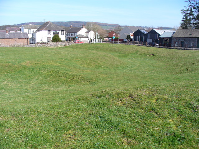
King Arthur's Round Table Henge
- Overview About King Arthur's Round Table Map Street View King Arthur's Round Table Henge is located at the south of the village of Eamont Bridge in Cumbria. It is thought …

Co-Curate Page
Eamont Bridge (bridge)
- Overview About Eamont Bridge Map Street View The sandstone bridge over the River Eamont at Eamont Bridge (village) dates from the c.15th century. The bridge crossed the old county boundary …
Co-Curate Page
Yanwath Hall
- Overview Map Street View Yanwath Hall and farm is situated by the River Eamont to the north of the village of Yanwath in Cumbria. The hall incorporates a 14th century fortified …
Co-Curate Page
The Gate Inn, Yanwath
- Overview Map Street View The Gate Inn (aka 'The Yanwath Gate') is a public house and resturant in at Yanwath. The pub was originally two seperate houses, which were altered …
Co-Curate Page
Mayburgh Henge
- Overview About Mayburgh Henge Map Street View Henges are ritual or ceremonial sites which date to the Late Neolithic period (2800-2000 BC). Mayburgh Henge is located close to the confluence …


