Topics > Civil Parishes in Cumbria > Wasdale Civil Parish > Historic Buildings and Monuments in Wasdale
Historic Buildings and Monuments in Wasdale
Listed buildings and scheduled monuments in Wasdale Civil Parish, Cumbria, from the National Heritage List for England[1]. In the absence of a published 'local list', some other public buildings of interest may also be included. Use the Search (below) if looking for a specific building / monument.
| Structure | List No. | Grade | Built~ | Note |
|---|---|---|---|---|
| Boundary Stone Circa 15 Feet East of Overbeck Bridge on North Side of Road | 1343667 | II | C19th | Nether Wasdale |
| Church of St Michael and All Angels | 1343668 | II* | 1535 | Nether Wasdale |
| Church of St Olaf | 1086640 | II | C16th | Wasdale Head |
| Craghouse Bridge | 1357568 | II | C18th | Partly in this parish |
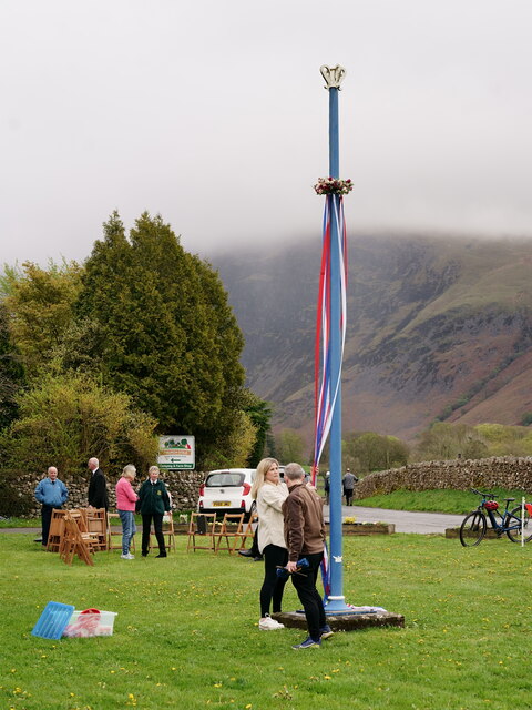
| Maypole to South West of Church | 1086639 | II | 1897 | Nether Wasdale |
| Row Bridge North of Hotel | 1343669 | II | C18th | Wasdale Head. Packhorse bridge |
| Stang Ends Farm Cottage with Adjoining Barn and House | 1336021 | II | 1778 | |
| Woodhow Farmhouse with Attached Byres, Area Walls and Pump | 1336047 | II | 1757 | Nether Wasdale |
| Gray Borran group of cairns | 1007227 | n/a | Prehistoric | Scheduled Monument |
| Yokerill Hows, group of seven cairns | 1007228 | n/a | Prehistoric | Scheduled Monument |
| Cairnfield south of Straighthead Gill, Burnmoor | 1008535 | n/a | Prehistoric | Scheduled Monument. Partly in this parish. |
| Mecklin Park cairnfield, 500m north of Ain House | 1007238 | n/a | Prehistoric | Scheduled Monument. Partly in this parish. |
| Old Hollins Bridge | Not listed | n/a | Disused bridge |
Primary source: the National Heritage List for England - NHLE is the register of nationally protected historic buildings and sites in England, including listed buildings, scheduled monuments, protected wrecks, registered parks and gardens, and battlefields. The list is maintained by Historic England. Check NHLE for updates and new entries. Secondary sources: British Listed Buildings.
Co-Curate Page
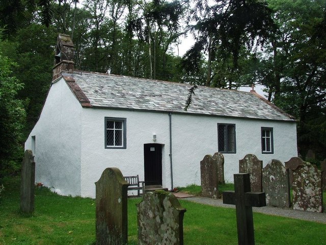
Church of St Michael & All Angels, Nether Wasdale
- Overview Map St Michael & All Angels Church in Nether Wasdale is thought to date from the 15th century.[1] The Parish Church was originally a chapel of ease to the …
Co-Curate Page
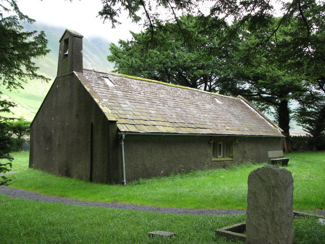
Church of St Olaf, Wasdale Head
- Overview About `st Olaf's Church Map St Olaf's Church in Wasdale Head, Cumbria, is England's smallest parish church. The earliest record of the church is from 1550, though it …
Co-Curate Page
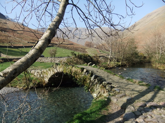
Packhorse Bridge, Wasdale Head
- Overview Map Street View Row Bridge, usually referred to as "Packhorse Bridge", is an c.18th century footbridge over Mosedale Beck. It is located in Wasdale Head, a short distance north …

Co-Curate Page
Old Hollins Bridge
- Overview Map Old Hollins Bridge is a dramatic humpback bridge over the River Irt. It is located about ¼mile south-west of Hollins Farm, in Wasdale, Cumbria. Just 14 metres upstream …

Co-Curate Page
Craghouse Bridge over the River Irt
- Overview Map Craghouse Bridge is a stone road bridge that carries Crag Lane over the River Irt in Cumbria. The single segmental arched bridge dates from the 18th century. The …

Co-Curate Page
Church of St Michael & All Angels, Nether Wasdale
- Overview Map St Michael & All Angels Church in Nether Wasdale is thought to date from the 15th century.[1] The Parish Church was originally a chapel of ease to the …
Co-Curate Page
Church of St Olaf, Wasdale Head
- Overview About `st Olaf's Church Map St Olaf's Church in Wasdale Head, Cumbria, is England's smallest parish church. The earliest record of the church is from 1550, though it …
Co-Curate Page
Packhorse Bridge, Wasdale Head
- Overview Map Street View Row Bridge, usually referred to as "Packhorse Bridge", is an c.18th century footbridge over Mosedale Beck. It is located in Wasdale Head, a short distance north …
Co-Curate Page
Old Hollins Bridge
- Overview Map Old Hollins Bridge is a dramatic humpback bridge over the River Irt. It is located about ¼mile south-west of Hollins Farm, in Wasdale, Cumbria. Just 14 metres upstream …
")
")
")

