Topics > Civil Parishes in Cumbria > Ulpha Civil Parish > Historic Buildings and Monuments in Ulpha Civil Parish
Historic Buildings and Monuments in Ulpha Civil Parish
Listed buildings and scheduled monuments in Ulpha Civil Parish, Cumbria, from the National Heritage List for England[1]. Use the Search (below) if looking for a specific building / monument.
| Structure | List No. | Grade | Built~ | Note |
|---|---|---|---|---|
| Bridge on Old Coach Road | 1380234 | II | ||
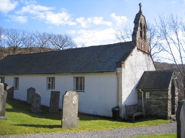
| Church of St John | 1068873 | II* | C17th | Ulpha |
| Holme Cottage | 1343663 | II | ||
| Loganbeck Farmhouse and Adjoining Barn | 1086641 | II | ||
| Sundial in Churchyard to North of Church | 1086642 | II | ||
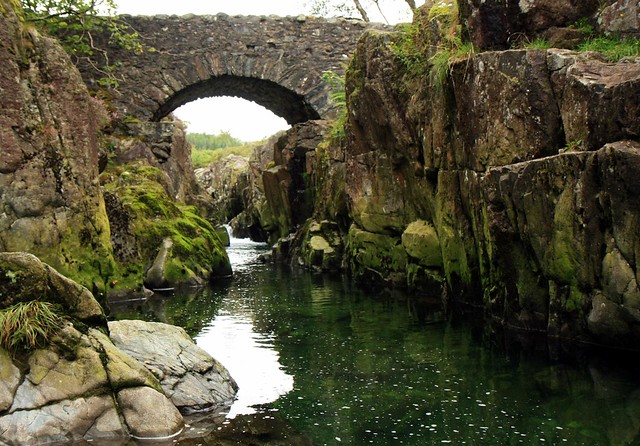
| Birks Bridge | 1086826 | II | C18th | Partly in this parish |
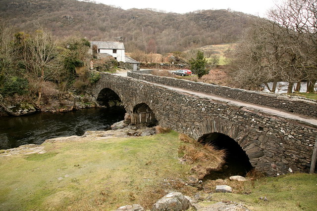
| Ulpha Bridge | 1086831 | II | C17th | Partly in this parish |
| Sike Moss prehistoric cairnfield and two ring cairns 215m north east of Woodend Bridge | 1020199 | n/a | Scheduled Monument | |
| Brown Rigg prehistoric cairnfield and a funerary cairn 400m south east of Woodend Bridge | 1020201 | n/a | Scheduled Monument | |
| Brown Rigg prehistoric cairnfield 375m east of Woodend Bridge | 1020200 | n/a | Scheduled Monument | |
| Prehistoric cairnfield 420m north east of Winds Gate | 1020204 | n/a | Scheduled Monument | |
| Rough Crag prehistoric cairnfield, funerary cairn and a linear boundary 1000m ENE of Woodend Bridge | 1020203 | n/a | Scheduled Monument | |
| Rough Crag prehistoric cairnfield and associated field system 600m ENE of Woodend Bridge | 1020202 | n/a | Scheduled Monument | |
| Prehistoric hut circle settlement and cairnfield, three medieval settlements and associated field systems, and two shielings north of Crosbythwaite | 1020278 | n/a | Scheduled Monument | |
| Crosby Gill prehistoric cairnfield and field system and a dispersed medieval settlement and associated lynchets 450m west of Crosbythwaite | 1020279 | n/a | Scheduled Monument | |
| Hesk Fell prehistoric cairnfield and funerary cairn, a linear boundary, and a dispersed medieval settlement and field system 840m west of Horseman Gate | 1020280 | n/a | Scheduled Monument | |
| Prehistoric cairnfield and linear boundary on Hesk Fell 800m north of Holehouse Bridge | 1021142 | n/a | Scheduled Monument | |
| Prehistoric cairnfield and associated field system 630m east of the confluence of Hall Beck and Devoke Water | 1019928 | n/a | Scheduled Monument | |
| Prehistoric round cairn on Whitfell | 1017182 | n/a | Scheduled Monument | |
| Roman road from Wrynose Bottom to Hardknott Ford | 1003266 | n/a | Scheduled Monument |
Primary source: the National Heritage List for England - NHLE is the register of nationally protected historic buildings and sites in England, including listed buildings, scheduled monuments, protected wrecks, registered parks and gardens, and battlefields. The list is maintained by Historic England. Check NHLE for updates and new entries. Secondary sources: British Listed Buildings.


