Topics > Civil Parishes in Cumbria > Shap Rural Civil Parish > Historic Buildings and Monuments in Shap Rural Civil Parish
Historic Buildings and Monuments in Shap Rural Civil Parish
Listed buildings and scheduled monuments in Shap Rural Civil Parish, Cumbria, from the National Heritage List for England[1]. Use the Search (below) if looking for a specific building / monument.
| Structure | List No. | Grade | Built~ | Note |
|---|---|---|---|---|
| Bridge over River Lowther | 1311085 | II | C17th | Rosgill |
| Hardendale Hall with Adjoinng Byres and Scullery | 1145388 | II | ||
| Limekiln to South East of Croft House, Opposite Entrance to Crag Lane | 1326753 | II | ||
| Mary's Pillar on East Side of Road Between Shap and Bampton Grange | 1311092 | II | 1854 | nr Rosgill |
| Naddle Old Bridge (Immediately to East of Present Bridge) | 1122016 | II | ||
| Parish Crag Bridge over Swindale Beck | 1145386 | II | C18th | |
| Scullery Range to East of Shap Abbey Farmhouse | 1159316 | II | ||
| Shap Abbey Farmhouse with Attached Byre Range | 1159288 | II | ||
| Threshing Barn and Byre to North East of Hardendale Hall | 1145389 | II | ||
| Wagon Shed and Byre to East of Hardendale Hall | 1159338 | II | ||
| Wagon Shed with Hay Loft to South East of Shap Abbey Farmhouse | 1145387 | II | ||
| Shap large regular stone circle | 1011639 | n/a | Scheduled Monument | |
| Shap Premonstratensian Abbey, including the precinct wall, abbey mill and mill race, and two fishponds | 1011636 | n/a | Scheduled Monument | |
| Medieval dyke system and shieling west of Shap Abbey | 1011638 | n/a | Scheduled Monument | |
| Hardendale medieval dispersed settlement and site of medieval monastic grange | 1016759 | n/a | Scheduled Monument | |
| Buck Park deerpound | 1007592 | n/a | Scheduled Monument | |
| Settlement SW of Naddle Bridge | 1007199 | n/a | Scheduled Monument | |
| Selside Pike round cairn | 1007591 | n/a | Scheduled Monument | |
| Gunnerkeld concentric stone circle | 1007608 | n/a | Scheduled Monument | |
| Round cairn on White Raise | 1007610 | n/a | Scheduled Monument | |
| Round cairn west of White Raise | 1007611 | n/a | Scheduled Monument | |
| Small stone circle 220m south-east of Castlehowe Scar | 1011610 | n/a | Scheduled Monument |
Primary source: the National Heritage List for England - NHLE is the register of nationally protected historic buildings and sites in England, including listed buildings, scheduled monuments, protected wrecks, registered parks and gardens, and battlefields. The list is maintained by Historic England. Check NHLE for updates and new entries. Secondary sources: British Listed Buildings.

Co-Curate Page
Rosgill Bridge
- Overview Map Street View Rosgill Bridge is a roadbridge over the River Lowther, located to the south-east of Rosgill in Cumbria. It was built in the late 17th century, replacing …

Co-Curate Page
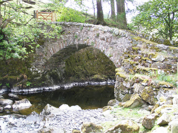
Parish Crag Bridge over Swindale Beck
- Overview Map Parish Crag Bridge is an 18th century Packhorse bridge over Swindale Beck, located about 1½ miles north-west of the village of Shap. The bridge has a single segmental …

Co-Curate Page
Mary's Pillar, Rosgill
- Overview Map Street View Mary's Pillar is located north of Rosgill. The monument was erected in 1854, by Thomas Castley, in memory of his daughter Mary, who died aged 24. …


Co-Curate Page
Rosgill Bridge
- Overview Map Street View Rosgill Bridge is a roadbridge over the River Lowther, located to the south-east of Rosgill in Cumbria. It was built in the late 17th century, replacing …

Co-Curate Page
Parish Crag Bridge over Swindale Beck
- Overview Map Parish Crag Bridge is an 18th century Packhorse bridge over Swindale Beck, located about 1½ miles north-west of the village of Shap. The bridge has a single segmental …


