Topics > County Durham > Civil Parishes in County Durham > Lartington Civil Parish > Historic Buildings and Monuments in Lartington Civil Parish
Historic Buildings and Monuments in Lartington Civil Parish
Listed buildings and scheduled monuments in Lartington Civil Parish, County Durham, from the National Heritage List for England[1]. Use the Search (below) if looking for a specific building / monument.
| Structure | List No. | Grade | Built~ | Note |
|---|---|---|---|---|
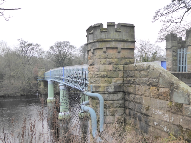
| Deepdale Aqueduct | 1121644 | II | 1898 | Partly in this parish. |
| Deepdale Cottage and Attached Sheds, 25 Metres North of Deepdale Aqueduct | 1121023 | II | ||
| Garden Wall and Gate Piers, South of the Grove | 1310511 | II | ||
| Garden Wall, with Statues and 2 Sets of Gate Piers, Adjoining to East of Lartington Hall | 1323083 | II | ||
| Gate Piers, End Piers, Gate and Linking Walls at Entrance to Lartington Squash Club | 1121024 | II | ||
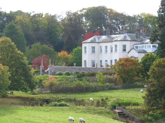
| Hansom House, Lartington Hall, Monk's Flat Witham Court | 1310603 | II* | 1635 | Lartington Hall |
| Lartington Aqueduct at National Grid Reference 0161 1758 | 1096894 | II | ||
| Mausoleum/Mortuary Chapel 90 Metres North of Yew Trees | 1121025 | II | ||
| North Gill Bridge | 1323056 | II | ||
| Outbuilding, 20 Metres West of the Grove | 1121028 | II | ||
| Park House | 1323045 | II | ||
| Shelter Shed 550 Metres South East of Lartington Hall | 1160560 | II | ||
| Six Flights of Garden Steps with Statues, to the East and South of Lartington Hall | 1160433 | II | ||
| The Beeches | 1160595 | II | ||
| The Grove | 1121027 | II | ||
| The Nook | 1323044 | II | ||
| The Thatch and Smithy Cottage | 1160536 | II | ||
| The Woodlands | 1121026 | II | ||
| Tower House | 1160545 | II | ||
| Lartington Hall | 1000731 | n/a | 1635 | Scheduled Monument |
| Carved rock in West Pasture 385m south west of The Rigg | 1018248 | n/a | Scheduled Monument | |
| Two carved rocks east of West Pasture, 335m south west of The Rigg | 1018249 | n/a | Scheduled Monument | |
| Four areas of carving on a rock outcrop 200m south west of The Rigg | 1018250 | n/a | Scheduled Monument | |
| Carved bedrock with cups and grooves 170m south east of The Rigg | 1018251 | n/a | Scheduled Monument | |
| Carved rock with one cup and four grooves 260m south west of The Rigg | 1018252 | n/a | Scheduled Monument | |
| Area of carved bedrock 120m south of The Rigg | 1018253 | n/a | Scheduled Monument | |
| Cup and ring marked rock 130m south west of West Loups's, Cotherstone Moor | 1018320 | n/a | Scheduled Monument | |
| Cup, ring and groove marked rock 170m south west of West Loups's, Cotherstone Moor | 1016595 | n/a | Scheduled Monument | |
| Cup, ring and groove marked rock on Kearton Rigg, 430m south of West Loups's, Cotherstone Moor | 1016596 | n/a | Scheduled Monument | |
| Deepdale Bridge | 1002321 | n/a | Scheduled Monument |
Primary source: the National Heritage List for England - NHLE is the register of nationally protected historic buildings and sites in England, including listed buildings, scheduled monuments, protected wrecks, registered parks and gardens, and battlefields. The list is maintained by Historic England. Check NHLE for updates and new entries. Secondary sources: British Listed Buildings and Keys to the Past.

Co-Curate Page
Deepdale Aqueduct
- Overview Map Street View This combined aquaduct and footbridge over the River Tees was built in 1898. The aqueduct is Grade II listed on the National Heritage List for England.


