Topics > County Durham > Civil Parishes in County Durham > Hunstanworth Civil Parish > Historic Buildings and Monuments in Hunstanworth Civil Parish
Historic Buildings and Monuments in Hunstanworth Civil Parish
Listed buildings and scheduled monuments in Hunstanworth Civil Parish, County Durham, from the National Heritage List for England[1]. Use the Search (below) if looking for a specific building / monument.
| Structure | List No. | Grade | Built~ | Note |
|---|---|---|---|---|
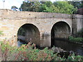
| Blanchland Bridge, Partly in County of Northumberland | 1229851 | II | C18th | |
| Boundary Stone About 100 Metres East of Road to Stanhope, on Parish Boundary | 1279145 | II | C19th | |
| Boundary Stone at Dead Friar | 1230502 | II | C19th | B6278 |
| Buckshott Farmhouse and Byres Adjoining | 1229335 | II | C17th | B6306 |
| Chimney of Engine House at Sikehead Lead Mine | 1229528 | II | C19th | Allenshields and Buckshott Moor |
| Chimney, Building Abutting and Larger Building | 1229598 | II | C19th | Ramshaw |
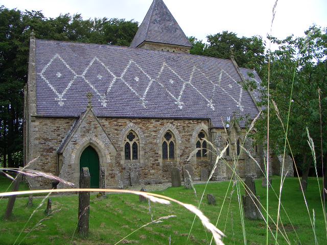
| Church of St James | 1229537 | II* | 1863 | On medieval site. |
| Corner Cottage, Mansion Cottage | 1229573 | II | 1863 | Hunstanworth |
| Courtyard and Orchard Walls in Front of Stable Block | 1229585 | II | C19th? | Hunstanworth |
| Former School and House Attached (Old Church House) | 1278995 | II | c.1862 | Hunstanworth |
| Former Vicarage with Terrace Retaining Wall and Steps | 1279150 | II | c.1863 | Hunstanworth |
| Giant's Stride, west of The Old School, in former schoolyard | 1229910 | II | 1866 | Playground stride, Townfield School |
| High Garden House | 1229671 | II | c.1863 | Hunstanworth |
| Hunstanworth Farm East Byre Range | 1229595 | II | c.1863 | Hunstanworth |
| Hunstanworth Farm North Range | 1278997 | II | c.1863 | Hunstanworth |
| Hunstanworth Farm West Range | 1229594 | II | c.1863 | Hunstanworth |
| Hunstanworth Farmhouse | 1229593 | II | c.1863 | Hunstanworth |
| Mill Cottage and House Adjoining at Jamieson's Mill | 1229763 | II | C19th | Ramshaw |
| Moor View (House Opposite Church, Shown As Os Map As Shangri La) | 1229589 | II | c.1863 | Hunstanworth |
| Outbuilding North of Townfield House | 1229599 | II | C19th? | Townfield |
| Outbuilding South of Ramshaw House | 1278999 | II | c.1840 | Ramshaw |
| Ramshaw House and Attached Outbuildings | 1229597 | II | c.1840 | Ramshaw |
| Range to East of Hunstanworth Farm East Byre Range | 1278998 | II | c.1863 | Hunstanworth |
| School House | 1229923 | II | c.1863 | Townfield |
| Sledge Meadows | 1229596 | II | 1619 | by Little Nookton Burn |
| Smelt Mill Flue Chimney About 50 Metres East of Spikehead Dam | 1279148 | II | C19th? | |
| South View Cottage | 1229337 | II | c.1863 | Hunstanworth |
| Stable Block of Former Vicarage | 1229338 | II | c.1863 | Hunstanworth |
| The Old School | 1229600 | II | c.1863 | Townfield |
| Tower in Churchyard of Church of St James | 1229336 | II | C16th | Hunstanworth |
| Townfield Cottages | 1229601 | II | c.1863 | Townfield |
| Townfield House | 1279001 | II | c.1863 | Former shop and reading room |
| Walls and gate in front of Hunstanworth Farm and farmhouse | 1278954 | II | c.1863 | Hunstanworth |
| Walls Around Former Schoolyard, and Letter Box | 1279002 | II | c.1863 | Townfield |
| Walls Enclosing Garden and Yard of Townfield House | 1229874 | II | c.1863 | Townfield |
| Walls in Front of Townfield Cottages | 1279003 | II | c.1863 | Townfield |
| Walls on North Side of Village Street in Front of South View, Woodside Cottage, the Cottage, Mansion | 1229592 | II | c.1863 | Hunstanworth |
| Walls on South Side of Village Street in Front of Ivy Cottage, Moor View and Old Church House | 1278996 | II | c.1863 | Hunstanworth |
| Walls, Piers and Gates Enclosing Yard of Church of St James | 1229558 | II | ? | Hunstanworth |
| West End, Pine Cottage and Ivy Cottage, with Area Wall and Gates | 1279149 | II | c.1863 | Hunstanworth |
| Lead mining remains at Ramshaw | 1015862 | n/a | C19th? | Scheduled Monument |
| Tower house in the churchyard of St James's Church | 1016926 | n/a | C16th | Scheduled Monument |
| Beldon lead mine and ore works at Beldon Shields | 1016462 | n/a | C18th | Scheduled Monument. Partly in Blanchland CP |
Primary source: the National Heritage List for England - NHLE is the register of nationally protected historic buildings and sites in England, including listed buildings, scheduled monuments, protected wrecks, registered parks and gardens, and battlefields. The list is maintained by Historic England. Check NHLE for updates and new entries. Secondary sources: British Listed Buildings and Keys to the Past.

Co-Curate Page
Blanchland Bridge
- Overview Map Street View The stone arched bridge over the River Derwent at Blanchland was built in the mid 18th century; it is Grade II listed. The south end of …