Topics > Healthcare > Hospitals > Former Hospital
Co-Curate Page
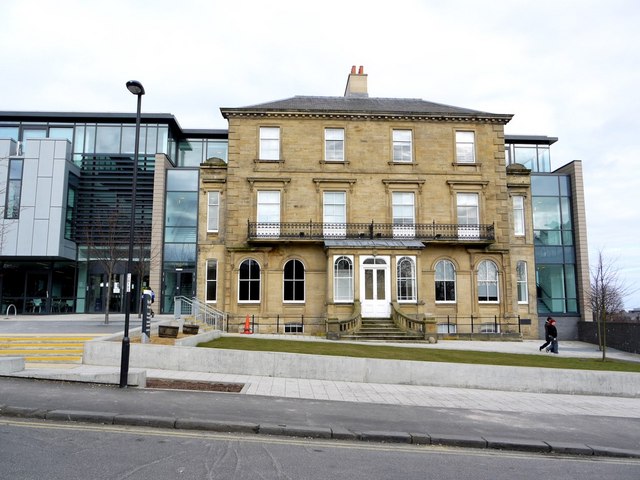
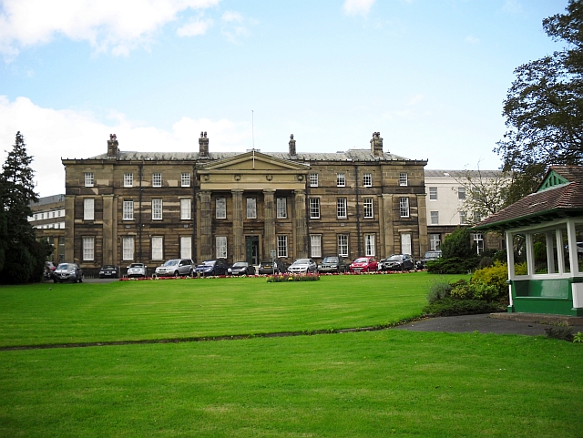
Rye Hill House, NCG
- Overview Map Street View Rye Hill House is the headquarters of NCG (who manage a group of 6 colleges, including Newcastle College). The building dates from c.1840[1]. It was originally …
Co-Curate Page
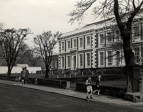
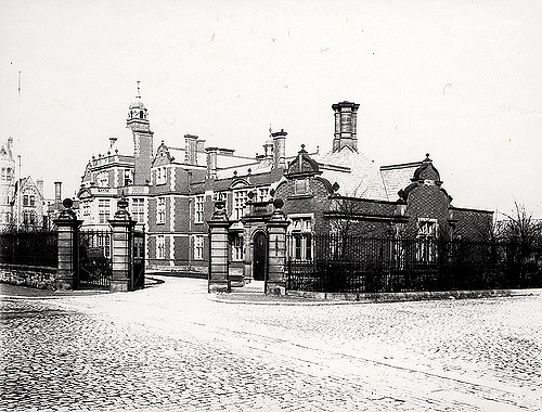
Lying-in Hospital
- The former Lying-in Hospal was a charitable asylum for poor married pregnant women. Located on New Bridge Street, Newcastle, the building was completed in 1826 on land given by the …
Co-Curate Page
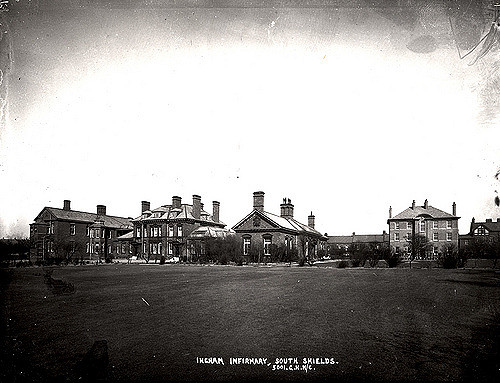
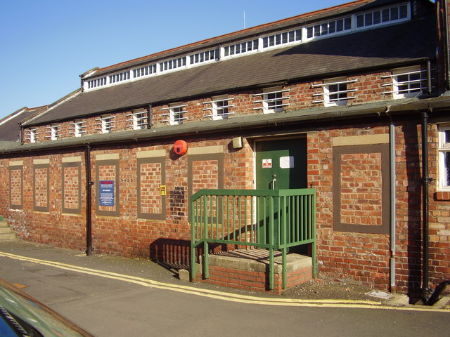
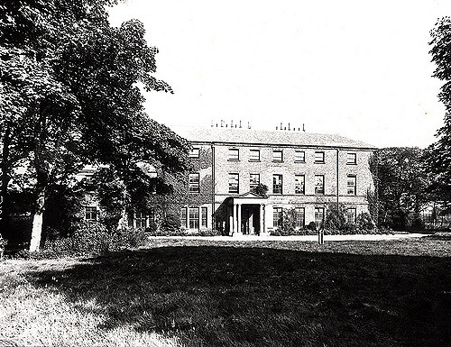
Newcastle General Hospital (1870 - 2010)
- Overview About Newcastle General Newcastle General Hospital (NGH) was for many years the main hospital for the city of Newcastle upon Tyne, England, and is managed by Newcastle upon …
Co-Curate Page
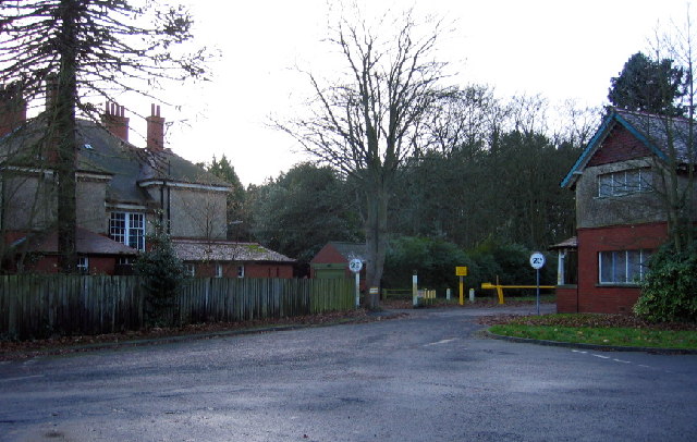
St Mary's Hospital, North Saltwick (1914 - 1995)
- Overview About St Mary's Hospital Map St Mary's Hospital, near North Saltwick and about 2 miles north-west of Stannington in Northumberland, originally opened as Gateshead Borough Lunatic Asylum in 1914. …
Co-Curate Page
Fleming Memorial Hospital (1888 - 1988)
- Overview Map Street View The Fleming (business centre) is located off Burdon Terrace in Jesmond, Newcastle. It was originally The Fleming Memorial Hospital, which was officially opened by Lord Armstrong …
Co-Curate Page
Wallsend Hall
- Overview Memorial Hospital Map Street View Wallsend Hall is located on The Green in Wallsend. The house was built in the early 19th century and had significant grounds. The Hall …
Co-Curate Page
Old Cumberland Infirmary
- Overview Map Street View The original Cumberland Infirmary on Newtown Road in Carlisle was built 1830-1832 by Richard Tattersall, funded by wealthy benefactors, and made available for charity patients. The …
Co-Curate Page
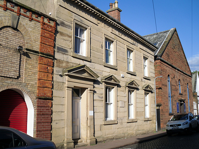
Old Dispensary, Carlisle
- Overview Map Street View The Dispensary is located at No. 6, Chapel Street, Carlisle. It was built in 1857, deigned by John Hodgson of Carlisle, to rehouse the Dispensary (a …
Co-Curate Page
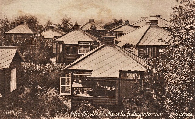
Meathop Sanatorium
- Overview Map Street View Westmorland Consumption Sanatorium, an isolation hospital for poor people with tuberculosis, was located at Meathop, near Grange over Sands. It was opened as a convalescent home …

Co-Curate Page
Rye Hill House, NCG
- Overview Map Street View Rye Hill House is the headquarters of NCG (who manage a group of 6 colleges, including Newcastle College). The building dates from c.1840[1]. It was originally …
Co-Curate Page
Lying-in Hospital
- The former Lying-in Hospal was a charitable asylum for poor married pregnant women. Located on New Bridge Street, Newcastle, the building was completed in 1826 on land given by the …
Co-Curate Page
Newcastle General Hospital (1870 - 2010)
- Overview About Newcastle General Newcastle General Hospital (NGH) was for many years the main hospital for the city of Newcastle upon Tyne, England, and is managed by Newcastle upon …
Co-Curate Page
St Mary's Hospital, North Saltwick (1914 - 1995)
- Overview About St Mary's Hospital Map St Mary's Hospital, near North Saltwick and about 2 miles north-west of Stannington in Northumberland, originally opened as Gateshead Borough Lunatic Asylum in 1914. …
Co-Curate Page
Fleming Memorial Hospital (1888 - 1988)
- Overview Map Street View The Fleming (business centre) is located off Burdon Terrace in Jesmond, Newcastle. It was originally The Fleming Memorial Hospital, which was officially opened by Lord Armstrong …
Co-Curate Page
Wallsend Hall
- Overview Memorial Hospital Map Street View Wallsend Hall is located on The Green in Wallsend. The house was built in the early 19th century and had significant grounds. The Hall …
Co-Curate Page
Old Cumberland Infirmary
- Overview Map Street View The original Cumberland Infirmary on Newtown Road in Carlisle was built 1830-1832 by Richard Tattersall, funded by wealthy benefactors, and made available for charity patients. The …
Co-Curate Page
Old Dispensary, Carlisle
- Overview Map Street View The Dispensary is located at No. 6, Chapel Street, Carlisle. It was built in 1857, deigned by John Hodgson of Carlisle, to rehouse the Dispensary (a …