Topics > Industry and Work > Farming > Farms > Former Farm

Co-Curate Page
West Cawledge Park
- Overview Map West Cawledge Park is a former dairy farm which supplied milk to Alnwick until the 1950s. The land was dispersed to adjoining farms in the 1960s. The owners …

Co-Curate Page
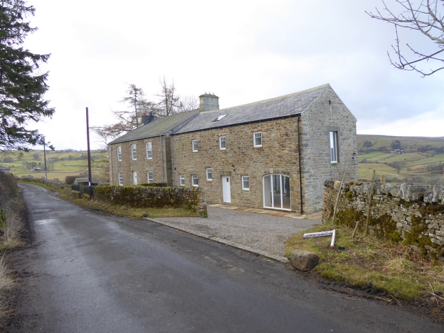
Hartlaw
- Overview Map Street View Hartlaw (aka Hart Law) is a hamlet in Northumberland located about 4½ miles south of Alnwick and 3 miles north-west of Acklington. Hart Law was a …

Co-Curate Page
Appletree Shield (ruins)
- The castlesque ruins of the former Appletree Shield farm, by Wellhope Burn, are located about 2 miles south-west of Ninebanks in West Allen. Whellan's 1855 directory of Northumberland lists Appletree …
Co-Curate Page
Bates Hill, West Allen
- Overview Map Street View Bates Hill is a former(?) farm by the River West Allen in Northumberland. The farmhouse was renovated (sold in 2015) and the adjacent Bates Hill Barn …
Co-Curate Page
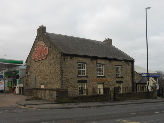
Solomons (former Thorntree Farm), West Road
- Overview Map Street View Solomons is a resturant on the West Road in Denton Burn, Newcastle. It was formerly Thorntree Farmhouse (aka Denton Burn Farm). The building dates from c.1790, built …

Co-Curate Page
Oakpool, Allendale
- Overview Map Street View Oakpool (aka Oak Pool) is located on Appletree Bank (road), by the west bank of River East Allen, about 2 miles north-west of Allendale Town. Whellan's …

Co-Curate Page
Lanehead, Allendale
- Overview Map Street View Lanehead (aka Lane Head) is located about 2¾ miles north-west of Allendale Town and 1 mile east of Bearsbridge. Originally, there was a bastle here, built …
Co-Curate Page
Rake House Farm
- Overview Map Street View Rake House is a small-business and office complex, based on a former farm on Rake Lane in Preston Grange, North Shields. The former farmhouse dates from …
Co-Curate Page
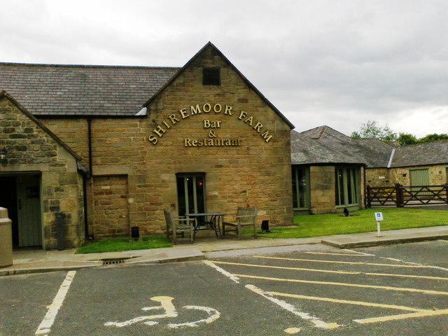
Shiremoor House Farm
- Overview Map Street View Shiremoor House Farm is a public house and resturant, located in a former farm at the north end of Middle Engine Lane, off Norham Road in …
Co-Curate Page
Angerton South Moor
- Overview Map Street View Angerton South Moor (aka Angertonmoor Cottage) is a former farmhouse, located about 7 miles west of Morpeth and ¾mile south-west of the hamlet of Low Angerton …
Co-Curate Page
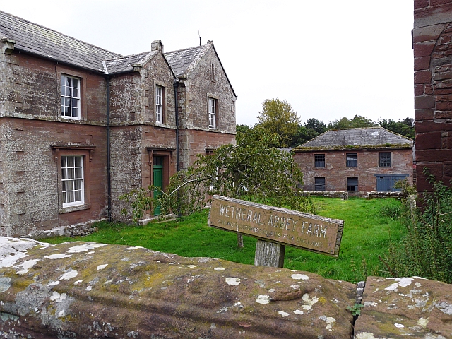
Wetheral Abbey Farm
- This is a Model farm, built in 1857 by James Stewart of Carlisle, incorporating parts of a medieval priory and a post-medieval farmstead. It is Grade II listed on the …

Co-Curate Page
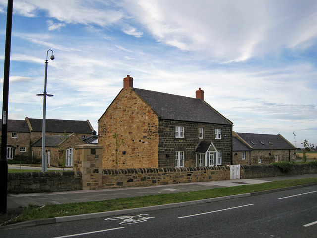
Green Farm, Wetheral
- The farmhouse of the former Green Farm is located on The Green in Wetheral. The house dates from the late 18th century. It is a Grade II listed building on …

Co-Curate Page
Old Farm, Skelwith Fold
- Old Farm and Old Farm Cottage are houses in Skelwith Fold. They date from the early 18th century and are Grade II listed on the National Heritage List for England.

Co-Curate Page
West Cawledge Park
- Overview Map West Cawledge Park is a former dairy farm which supplied milk to Alnwick until the 1950s. The land was dispersed to adjoining farms in the 1960s. The owners …
Co-Curate Page
Hartlaw
- Overview Map Street View Hartlaw (aka Hart Law) is a hamlet in Northumberland located about 4½ miles south of Alnwick and 3 miles north-west of Acklington. Hart Law was a …
Co-Curate Page
Appletree Shield (ruins)
- The castlesque ruins of the former Appletree Shield farm, by Wellhope Burn, are located about 2 miles south-west of Ninebanks in West Allen. Whellan's 1855 directory of Northumberland lists Appletree …
Co-Curate Page
Bates Hill, West Allen
- Overview Map Street View Bates Hill is a former(?) farm by the River West Allen in Northumberland. The farmhouse was renovated (sold in 2015) and the adjacent Bates Hill Barn …
Co-Curate Page
Solomons (former Thorntree Farm), West Road
- Overview Map Street View Solomons is a resturant on the West Road in Denton Burn, Newcastle. It was formerly Thorntree Farmhouse (aka Denton Burn Farm). The building dates from c.1790, built …
Co-Curate Page
Oakpool, Allendale
- Overview Map Street View Oakpool (aka Oak Pool) is located on Appletree Bank (road), by the west bank of River East Allen, about 2 miles north-west of Allendale Town. Whellan's …
Co-Curate Page
Lanehead, Allendale
- Overview Map Street View Lanehead (aka Lane Head) is located about 2¾ miles north-west of Allendale Town and 1 mile east of Bearsbridge. Originally, there was a bastle here, built …
Co-Curate Page
Rake House Farm
- Overview Map Street View Rake House is a small-business and office complex, based on a former farm on Rake Lane in Preston Grange, North Shields. The former farmhouse dates from …
Co-Curate Page
Shiremoor House Farm
- Overview Map Street View Shiremoor House Farm is a public house and resturant, located in a former farm at the north end of Middle Engine Lane, off Norham Road in …
Co-Curate Page
Angerton South Moor
- Overview Map Street View Angerton South Moor (aka Angertonmoor Cottage) is a former farmhouse, located about 7 miles west of Morpeth and ¾mile south-west of the hamlet of Low Angerton …
Co-Curate Page
Wetheral Abbey Farm
- This is a Model farm, built in 1857 by James Stewart of Carlisle, incorporating parts of a medieval priory and a post-medieval farmstead. It is Grade II listed on the …
Co-Curate Page
Green Farm, Wetheral
- The farmhouse of the former Green Farm is located on The Green in Wetheral. The house dates from the late 18th century. It is a Grade II listed building on …