Topics > Northumberland > Ray Demesne > Fishpond, SW of Ray Cottages
Fishpond, SW of Ray Cottages
Scheduled Monument (#1011110): Fishpond, 400m south-west of Ray Cottages
Click the headings below to expand (selected extracts from the Historic England scheduling)
The fishpond at Ray survives well and retains significant archaeological remains. Well preserved examples are not common in this area; and it is also associated with other remains of medieval settlement at Ray, including a bastle.
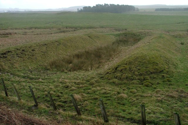
The monument includes a medieval fishpond, situated to the south-west of Ray bastle, and to the north-west of the deserted medieval hamlet of Ray. The fishpond, orientated north-south, is of simple form and consists of a single rectangular pond 40m by 7.5m with a flat bottom. The spoil dug from the pond has been used to form surrounding banks on the east and west sides which stand to a maximum height of 2.1m and are an average of 7.5m wide. The northern end of the pond is delimited by a scarped bank and the southern end by a slight bank with gaps in the south-east and the south-west corners; it is here that leats leading from the nearby stream and controlled by sluices would have led water into and out of the pond. The remains of a dividing bank 3.5m wide is visible half way along the pond. Immediately to the west of the pond, and parallel to it, there is an earthen bank 3m wide. The nature of this bank is unclear but it appears to be associated with the fishpond. The bastle at Ray is the subject of a separate scheduling, and it is likely that construction and use of the fishpond was closely associated with occupation of this building.