Topics > Northumberland > Doddington > Dod Law Hillforts
Dod Law Hillforts
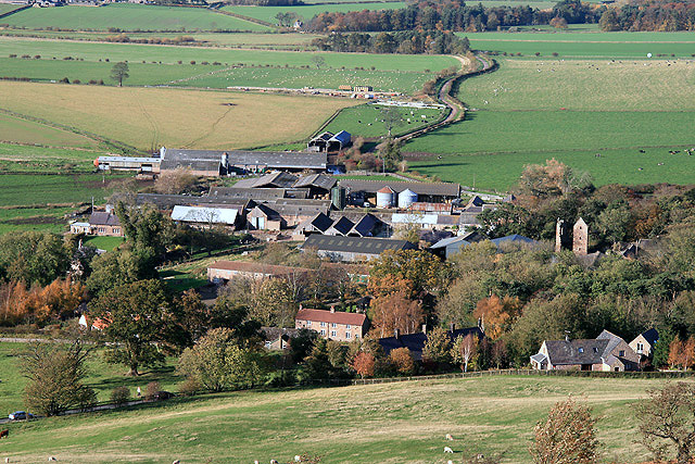
Dod Law is a prominent ridge, which rises to the highest point of Doddington Moor (trig point at 200m). It is located about half mile south-east of Doddinton village in Northumberland. Dod Law features a cluster of three adjacent hillforts. These Iron Age sites are referred to as Dod Law West, Dod Law Middle (or Main), and Dod Law East, each featuring substantial earth and stone ramparts.
- Dod Law West: a bivallate fort with an annex, notable for having two main ramparts and a separate single-rampart annex to the northwest.
- Dod Law Middle/Main: an enclosure featuring an outer stony bank and an inner bank to the northeast/south.
- Dod Law East: a smaller ovoid enclosure, or fort, with double banks.
Dod Law also has several examples of prehistoric rock art, including cup-and-ring marks, such as "Main Rock". Dod Law Middle and West, together with the cup and ring marked rocks are a Scheduled Monument (legally protected).

LIDAR of Dod Law West - Image from opendata.hillforts.eu (CC-BY-SA), based on data from the Environment Agency - National LIDAR programme
EN1932 East Dod Law, Northumberland
Click the headings below to expand (selected extracts from the Atlas of Hillforts of Britain and Ireland)
Lying to the E of Middle Dod Law Camp (Atlas No. 1931) and the most easterly of three sites on Dod Law. It lies on the summit of a slight rise at 160m OD with the ground sloping away gently in all directions. It comprises an oval earthwork measuring approximately 100m NW-SW by 70m SW-NE with two concentric earth and stone banks, enclosing 0.7ha. In 1955 the inner and better preserved bank varied between 4-5 in width and up to 0.5m high. The outer bank is only visible in the W and N and measures 3-4, wide and up to 0.4m high. Further faint traces of this bank can be seen in the E. Three gaps in the banks have been identified although the location of an original entrance is uncertain but might be in the W which gives access to lower ground The site is badly mutilated and the banks are much slighter than West and Middle Dod law. It lacks evidence for internal features, although two possible scoops might represent hut platforms. Interpreted as a hillfort by Northumberland HER and as a possible stock enclosure for nearby Middle Dod Law by English Heritage. An uncertain rock carving underlies the rampart in the NE but the marks could be due to weathering. On OS mapping (1885-1900). It is undated. A brief description and hachure plan was produced by Maddison and Sellars (1990).
Source: Lock, Gary and Ralston, Ian. 2024. Atlas of Hillforts of Britain and Ireland. Available at: https://hillforts.arch.ox.ac.uk (CC BY-SA 4.0)
EN1931 Middle Dod Law, Northumberland
Click the headings below to expand (selected extracts from the Atlas of Hillforts of Britain and Ireland)
Lying on Dod Law, 1km to the SE of Doddington and 135m to the E of the hillfort of Dod Law West (Atlas No. 0525) an enclosure of 0.5ha. Oval in plan approximately 85m by 90m, it comprises two banks and an outer ditch. It lies on level ground on the crest of a ridge at 198m OD which offers views in all directions. A gentle slope lies to the E. The inner bank survives poorly and is only measurable in the N where it is approximately 4m wide and 0.4m high. The rest of the circuit can be made out by the presence of a few stones protruding from the turf and it probably coincided with the top of a rocky escarpment in the W. The outer stone bank measures 3-5m wide and 0.3-1.4m high and is stronger in the W where it runs to the foot of the escarpment. The outer ditch has an average width of 8m and depth of 0.7m. Entrances lie in the NE and SW. The entrance in the NE gives access to the crest of the ridge and ground to the NE. The SW entrance has been disturbed through quarrying but the western terminal continues southwards beyond the entrance while the terminal in the E turns towards the W terminal forming a bottleneck. The entrance is further restricted by a bank placed centrally within the gap. Two further breaks which correspond with a track are probably modern. Hogg and Hogg (1956) reported hut circles, which was refuted by an RCHME field inspector in 1964. Jobey (1965) also reported stone huts as possibly secondary occupation. Shown on 1856-65 OS mapping and survives in poor condition. Further traces of bank have been recorded in the S and cup and ring marked stones lie in the vicinity. Scheduled but minimal investigations and remains undated.
Source: Lock, Gary and Ralston, Ian. 2024. Atlas of Hillforts of Britain and Ireland. Available at: https://hillforts.arch.ox.ac.uk (CC BY-SA 4.0)
EN0525 Dod Law West, Northumberland
Click the headings below to expand (selected extracts from the Atlas of Hillforts of Britain and Ireland)
An Iron Age bivallate hillfort with annex lying 850m to the SE of Doddington and 110m to the W of Dod Law East (Atlas No. 1932). D-shaped in plan with two earth and stone ramparts which enclose an area of 0.37ha. It is sited at 182m OD on ground which slopes away steeply in the S and SW with good views in most directions, but overlooked by a slight escarpment in the E and NE. The ramparts have been mutilated with the inner rampart 5-7m wide and standing 0.4-3m high and the outer rampart 6-8m wide and 12-2.5m high. A third bank, up to 0.5m high, lies on the southern side of the outward facing scarp and continues along the SW side of the earthwork. Excavation (Smith 1990) showed that the wall of the inner rampart stood approximately 3.2m wide and 1.5m high. There is no evidence of ditches. Entrances lie in the SE and NW. The ramparts at the SE entranceway are inturned, almost to the inner rampart, forming a passageway. In the NW the entrance opens into the annex. Up to ten possible hut circles between 4-8m in diameter and a possible kiln have been recorded within the interior. Two pairs of huts are connected by a slight wall with a central gateway. Where visible their entrances lie in the SE. One of the hut circles excavated in the 1920's was reported to have been well constructed from sandstone (anon. 1923-5). A further hut circle has been recorded outside on the N side. These probably represent Romano-British reuse of the site. The foundations of a rectangular building, probably modern, which has cut into the inner rampart, lies in the E. The single embanked annex ls appended to the outer rampart in the NW comprising a curving bank, 60m SW-NE by 37m transversely, enclosing 1.7ha. The enclosing bank is 3-5m wide and stands 0.5-0.8m high. It has an entrance in the W. Biological remains from the excavations suggests the occupants of the hillfort were producing their own crops and using plants from the moorland and valley bottom. Radiocarbon dates obtained from charred wood, charcoal and wheat chaff from the ramparts (Smith 1990) suggest the hillfort was constructed during the Iron Age in three phases, the earliest being a palisade and outer rampart of dump construction (c.500-200 BC). This was succeeded by a stone inner rampart (2nd century BC) which remained standing until AD 100. Partial destruction of the inner rampart occurred during the construction of the inner revetment of the outer rampart. The site is shown on 1856-65 OS mapping. Cup and ring-marked stones lie in close proximity to this hillfort.
Source: Lock, Gary and Ralston, Ian. 2024. Atlas of Hillforts of Britain and Ireland. Available at: https://hillforts.arch.ox.ac.uk (CC BY-SA 4.0)

from https://historicengland.org.u…
Two camps and cup and ring marked rocks on Dod Law - Scheduling
Added by
Simon Cotterill

from https://keystothepast.info/se…
West Camp on Dod Law (Doddington)
- ....Situated on near level ground just above the 600 foot contour with steep natural slopes (approx 1:2) to the SW. The site commands a good view on all side except …
Added by
Simon Cotterill
from https://keystothepast.info/se…
Middle Dod Law hillfort (Doddington)
- ....Situated on the crest of a ridge of high ground about 650 feet above sea level. Although the site commands an excellent view in all directions the position is not …
Added by
Simon Cotterill

from https://historicengland.org.u…
Two camps and cup and ring marked rocks on Dod Law - Scheduling
Added by
Simon Cotterill
from https://keystothepast.info/se…
West Camp on Dod Law (Doddington)
- ....Situated on near level ground just above the 600 foot contour with steep natural slopes (approx 1:2) to the SW. The site commands a good view on all side except …
Added by
Simon Cotterill
from https://keystothepast.info/se…
Middle Dod Law hillfort (Doddington)
- ....Situated on the crest of a ridge of high ground about 650 feet above sea level. Although the site commands an excellent view in all directions the position is not …
Added by
Simon Cotterill

")
