Topics > Northumberland > Blakehopeburnhaugh
Blakehopeburnhaugh
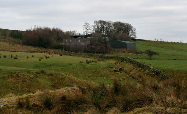
Blakehopeburnhaugh is a farm in Redesdale Forest, located about ¼mile south-west of the A68 and 8 miles north-west of Otterburn. The farm is situated by Blakehope Burn, close to it's confluence with the River Rede. The Pennine Way passes through Blakehopeburnhaugh, taking a bridge over Blakehope Burn, by which there is a car park and picnic area. There is also a bridge over the River Rede on the Pennine Way here. At the side of the A68, about ¼mile north-east of the farm, is an old milestone, which provides a reminder that this was once a Turnpike road. Blakehopeburnhaugh is included in the 1860 Northumberland Farm Index, listed under the township of Troughend, in the ancient parish of Elsdon. Today, Blakehopeburnhaugh is part of Rochester with Byrness Civil Parish.