Topics > Northumberland > Berwick upon Tweed > Berwick-upon-Tweed, 1855
Berwick-upon-Tweed, 1855
Extract from: History, Topography, and Directory of Northumberland...Whellan, William, & Co, 1855.
BERWICK-UPON-TWEED
BERWICK-UPON-TWEED, a county, parish, seaport, and borough, is pleasantly situated on the north side of the Tweed, within half a mile of its confluence with the ocean, 337 miles north by west of London, fifty four south-east of Edinburgh, and sixty-four north by west of Newcastle-upon-Tyne. From its position on the confines of England and Scotland, it is not considered to belong to either country, but to be a neutral town in the kingdom of Great Britain. Its name is supposed by Leland to have been originally Aberwick, from the Celtic Aber, the mouth of a river, and wic, a town. Camden and some others derive it from Banricct, a" manor village." Dr. Boswell, says it meant the town of the Bernicians (Berniciornm Vicus), while others give various etymologies, none of which are more satisfactory than those just presented to the reader.
The county or liberty of Berwick, forms nearly an equilateral triangle, whose sides are each about two miles in length, extending northward from the harbour's entrance to Lamberton grounds, and thence in a south-westerly direction to the Tweed, which forms the southern limit, whilst the sea and Berwickshire in Scotland, constitute respectively the northern and western boundaries. Within the liberties, which form one parish, are a number of private estates; a part is let out upon leases, and the remainder, measuring about 4,500 acres, is parcelled out into separate allotments called "Burgess Meadows,'' or stints, which are occupied by the oldest burgesses or their widows, and are worth from £5 to £15 each per annum. The parish of Berwick-upon-Tweed, comprises an area of 6,195 statute acres; its population in 1801, was 7,187; in 1811, 7,746; in 1821, 8,723; in 1831, 8,920; in 1841, 8,484; and in 1851, 10,294 souls. At the last mentioned period there were 1,384 inhabited houses, fifty-four uninhabited houses, and thirteen in process of erection.
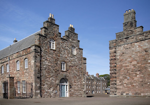
THE TOWN of Berwick is equally celebrated in the annals of England and Scotland. Seated on a gentle declivity, forming the northern bank of the river, it enjoys a favourable southern aspect, and includes within its walls an area of little less than two miles in circumference. The town is fortified, but the works are chiefly modern, and of the ancient fortifications few traces now remain. The following is Fuller's description of the fortifications. '' Meg's Mount demi-Bastion, with a double flank on the right (south-west corner of the wall, looking on the Tweed). Cumber1and Bastion, with upper and retired works to scour the ditch. Brass Mount Bastion, under the cavalier, are two casemented powder-magazines, covered by the retired flanks on right and left (north-east corner). Windmill Mount, with double flanks, a powder-magazine between the Windmill Mount and King's Bastion. King's Demi-Bastion without a cavalier, has a flagstaff and retired flank on the left. Fisher's Fort, or Six-gun Battery, near the Governor's house. Bramham's, or Four-gun Battery. The two last batteries commanded the bar and entrance to the harbour. Coxon's Tower, near it on the right, for holding powder, ammunition etc. Saluting Battery, on ·which are mounted twenty-two four pounders, near the Governor's House. The master Gunner's Magazine is in Palace Green, formerly a reservoir of water. The walls and batteries mount fifty-four pieces of ordnance." The walls and batteries are just the same in the present day. The cannon, etc., were taken from the walls after the general peace, and are now in Edinburgh Castle. The ramparts constitute the principal walk in or near Berwick, and are much frequented by the inhabitants during the summer months. The suburb called Castlegate, is situated without the walls, near the north-west part of the town, and a long range of houses called the Greens, stretches from Castlegate eastwards. The southern suburb, Tweedmouth, on the opposite side of the river, will be found described at page 928. Various improvements have been made from time to time in the old borough the houses in Bridge-street, immediately facing the English Gate, and on either side one after another have been removed the clumsy shambles have been swept away, their site forming a good Corn Market, and instead of the oil lamps "dimly burning,” we have now bright jets of gas, whose light enables us to tread our way with safety through the streets of this ancient town.