Topics > Northumberland > Civil Parishes in Northumberland > Denwick Civil Parish > Alnwick South Side
Alnwick South Side
ALNWICK SOUTH SIDE is a township including the hamlets of Cauledge Park, Greensfield, Grumwells Park, Hobberlaw, Rugley, Shieldykes, and Snipe House. It comprises an area of 4,760 acres, the property of the Duke of Northumberland, who is also lord of the manor, and the number of its inhabitants in 1841, was 297; and in 1851, 278 souls. The various townships in Alnwick parish were included in one return, previous to the year 1841.
Extract from: History, Topography, and Directory of Northumberland...Whellan, William, & Co, 1855. [full directory entry]

Co-Curate Page
East Cawledge
- Overview Map Street View East Cawledge (historic spelling: Cauledge) is a hamlet located about half mile south-east of Alnwick. There is East Cawledge Farm and a couple of cottages, situated …


Co-Curate Page
West Cawledge Park
- Overview Map West Cawledge Park is a former dairy farm which supplied milk to Alnwick until the 1950s. The land was dispersed to adjoining farms in the 1960s. The owners …

Co-Curate Page
Rugley, Denwick
- Overview Map Street View Rugley Farm is located off Rugley Road, about 2 miles south-west of Alnwick. Rugley Burn flows to the north of the farm, past Rugley Woods. Old …
Co-Curate Page
Shiel Dykes
- Overview Map Street View Shiel Dykes (Shield Dykes, Shieldykes) is a hamlet / farm, located about 5 miles south-west of Alnwick and 1½ miles north-west of Newton on the Moor …

Co-Curate Page
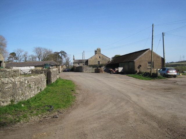
Greensfield Moor Farm (Denwick)
- Overview Map Street View Greensfield Moor Farm is located off the A1 about 1 mile south of Alnwick town centre. It is situated to the north of Cawledge Burn. The …

Co-Curate Page
Hobberlaw
- Overview Map Street View Hobberlaw is a farm in Northumberland, located off Rugley Road, south west of Alnwick. A settlement existed here in medieval times, which was part of the …
Co-Curate Page
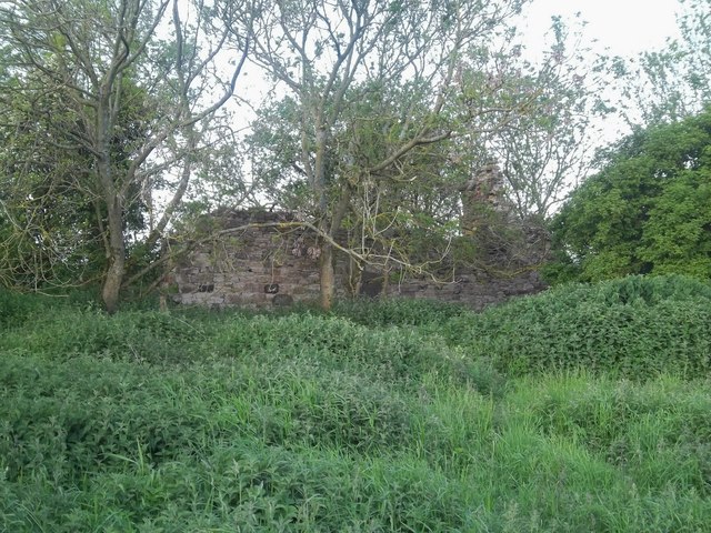
High Hobberlaw
- Overview Map High Hobberlaw is a former farm, located to the south-west of Alnwick and to the north of Hobberlaw. A couple of ruined buildings remain. Alnwick Racecource was located …

Co-Curate Page
Snipe House, Denwick
- Overview Map Snipe House is a farm / hamlet in Northumberland, located about 3 miles south-west of Alnwick and 2 miles west of Shilbottle. Whellan's 1855 directory of Northumberland lists …

Co-Curate Page
St Margaret's Farm, Denwick
- Overview Map Street View St Margaret's is located about 2½ miles south-west of the town of Alnwick. It is situated near Firth Burn. Whellan's 1855 directory of Northumberland lists Thomas …

Co-Curate Page
East Cawledge
- Overview Map Street View East Cawledge (historic spelling: Cauledge) is a hamlet located about half mile south-east of Alnwick. There is East Cawledge Farm and a couple of cottages, situated …
Co-Curate Page
West Cawledge Park
- Overview Map West Cawledge Park is a former dairy farm which supplied milk to Alnwick until the 1950s. The land was dispersed to adjoining farms in the 1960s. The owners …
Co-Curate Page
Rugley, Denwick
- Overview Map Street View Rugley Farm is located off Rugley Road, about 2 miles south-west of Alnwick. Rugley Burn flows to the north of the farm, past Rugley Woods. Old …
Co-Curate Page
Shiel Dykes
- Overview Map Street View Shiel Dykes (Shield Dykes, Shieldykes) is a hamlet / farm, located about 5 miles south-west of Alnwick and 1½ miles north-west of Newton on the Moor …
Co-Curate Page
Greensfield Moor Farm (Denwick)
- Overview Map Street View Greensfield Moor Farm is located off the A1 about 1 mile south of Alnwick town centre. It is situated to the north of Cawledge Burn. The …
Co-Curate Page
Hobberlaw
- Overview Map Street View Hobberlaw is a farm in Northumberland, located off Rugley Road, south west of Alnwick. A settlement existed here in medieval times, which was part of the …
Co-Curate Page
High Hobberlaw
- Overview Map High Hobberlaw is a former farm, located to the south-west of Alnwick and to the north of Hobberlaw. A couple of ruined buildings remain. Alnwick Racecource was located …
Co-Curate Page
Snipe House, Denwick
- Overview Map Snipe House is a farm / hamlet in Northumberland, located about 3 miles south-west of Alnwick and 2 miles west of Shilbottle. Whellan's 1855 directory of Northumberland lists …


