Topics > Geography > Landforms > Whin Sill
Whin Sill
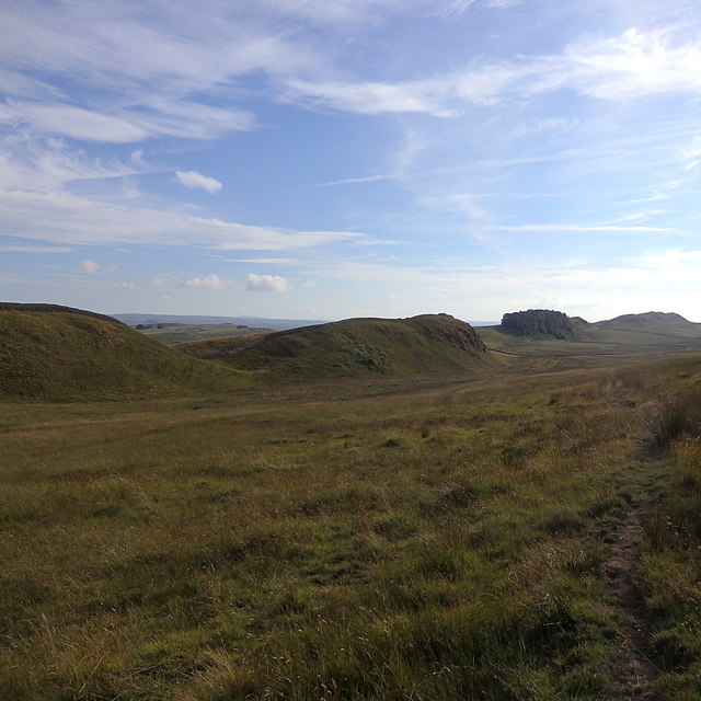
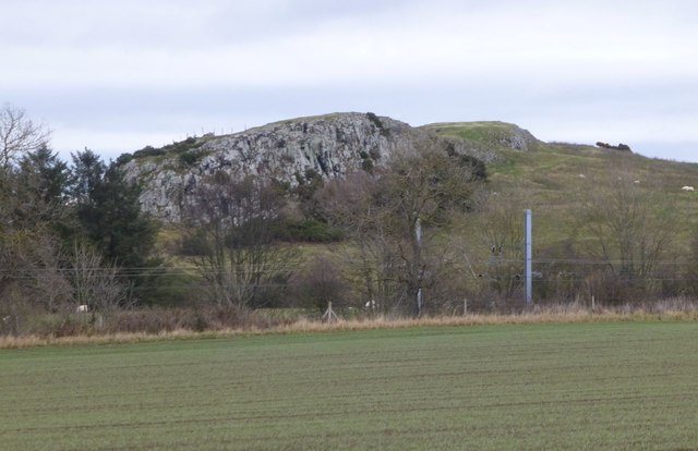
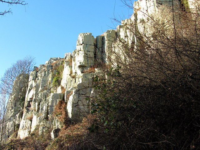
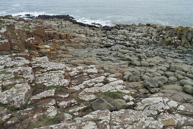
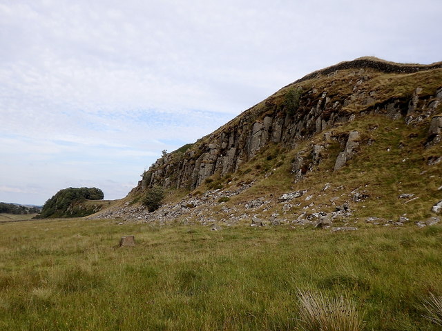
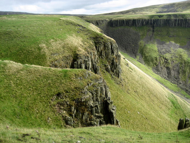
Whin Sill is a massive formation of dark, extremely hard, volcanic rock (dolerite), injected between softer sedimentary rocks (such as limestone, shale, or sandstone) in a series of eruptions, millions of years ago. It covers a large area in the North of England, stretching from Teesdale, north to Berwick and north-west to Cumbria. Whin Sill is mostly underground, but there intrusions where the hard rock is exposed at the surface.
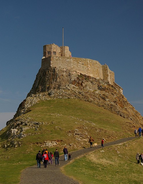
The Romans built Hadrian’s Wall along the line of the hard rocky crags of The Great Whin Sill, taking advantage of their natural defences. By the East Coast, Lindisfarne Castle and Dunstanburgh Castle, are examples of later defensive sites utilising intrusions of Whin Sill.
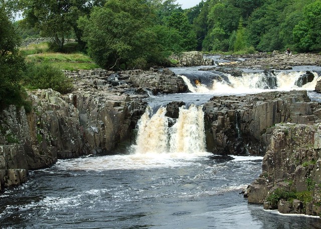
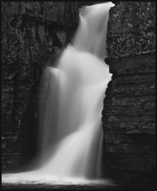
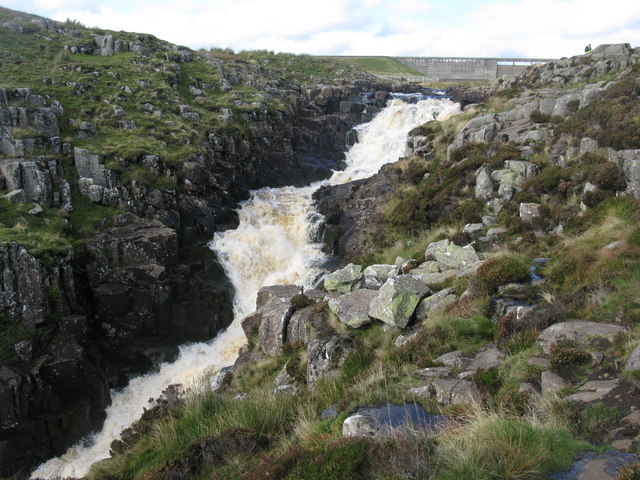
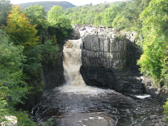
High Force, Low Force and Cauldron Snout are examples of waterfalls formed where the River Tees crosses the Whin Sill.


Co-Curate Page
Cauldron Snout, River Tees
- Overview About Cauldron Snout Map Cauldron Snout is a waterfall on the River Tees in Upper Teesdale, located just below the dam of the Cow Green Reservoir, on the boundary between …
Co-Curate Page
High Force Waterfall
- Overview About High Force Map Street View High Force is a waterfall on the River Tees in Upper Teesdale, located about 4 miles north-west of Middleton-in-Teesdale. The falls drop a …

from https://en.wikipedia.org/wiki…
Whin Sill
- The Whin Sill or Great Whin Sill is a tabular layer of the igneous rock dolerite in County Durham, Northumberland and Cumbria in the northeast of England. It lies partly …
Added by
Simon Cotterill


Co-Curate Page
Cauldron Snout, River Tees
- Overview About Cauldron Snout Map Cauldron Snout is a waterfall on the River Tees in Upper Teesdale, located just below the dam of the Cow Green Reservoir, on the boundary between …
Co-Curate Page
High Force Waterfall
- Overview About High Force Map Street View High Force is a waterfall on the River Tees in Upper Teesdale, located about 4 miles north-west of Middleton-in-Teesdale. The falls drop a …
from https://en.wikipedia.org/wiki…
Whin Sill
- The Whin Sill or Great Whin Sill is a tabular layer of the igneous rock dolerite in County Durham, Northumberland and Cumbria in the northeast of England. It lies partly …
Added by
Simon Cotterill


