Topics > Tyne and Wear > North Tyneside > West Allotment
West Allotment
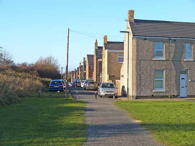
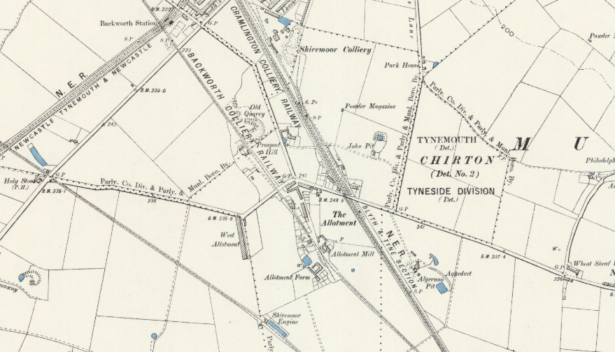
West Allotment is a village in North Tyneside, located immediately south-west of Shiremoor and north of Cobalt Business Park. It was originally part of common land known as Tynemouthshire Moor, which was divided and "allotted" to different villages during the Enclosure of communal lands in the late 18th century, eventually leading to the name "West Allotment". The settlement, originally known as "The Allotment" grew rapidly in the early-mid 19th century, with terraces built to house miners from nearby pits, including Hope Pit (opened by 1790), Algernon Pit (opened c.1820) and John Pit, and later owned by Backworth Collieries Ltd. Allotment Mill, located here, was Backworth Colliery's granary and feed preparation mill for pit pony fodder.
The original mining houses were demolished in the 1960s and 70s. However, the settlement, slightly to the west of The Allotment (hense "West Allotment"), continued to extended, including the Murrayfields and Holyfields estates built in the late 1990s. The West Allotment Community Centre, on Benton Road, was originally a workmen's institute, built in 1901 and later used as the local pay office of the Coal Board. Then in 1963, the building became the West Allotment Boys Club. In 2015, the building was refurbished and renamed West Allotment Community Centre. Also by Benton Road, is the war memorial commemorating 59 men of West Allotment, Old Allotment and district, who lost their lives in the First World War. The village is also known for West Allotment Celtic Football Club, which was founded in 1928 and joined the Northern Alliance in 1983, winning the title eight times before joining the Northern League in 2004.
West Allotment is a village in the Metropolitan Borough of North Tyneside. Prior to 1974 it was part of Northumberland. It is located approximately 4 miles (6.4 km) inland of Whitley Bay and approximately 3 miles (4.8 km) north of The Tyne Tunnel. A mile or so north of West Allotment, the extensive built-up areas of North Tyneside change abruptly into green belt stretching north into south east Northumberland.
West Allotment was originally a mining community. There is a War memorial situated on the old high street.
Silverlink Biodiversity Park is a local nature reserve adjacent to the village, which at the top of the hill has an ornate giant sundial at its summit.
West Allotment is the nearest village to the Cobalt Business Park in North Tyneside. The Cobalt is the UK's largest office park, and is the largest conglomeration of purpose-built office space in the Northern Hemisphere. Companies housed on the business park include Procter & Gamble, Orange, Santander UK, G4S; North Tyneside Council is also based there. West Allotment Newsbeat is the villages dedicated news and information service available via Facebook.
Housing estates
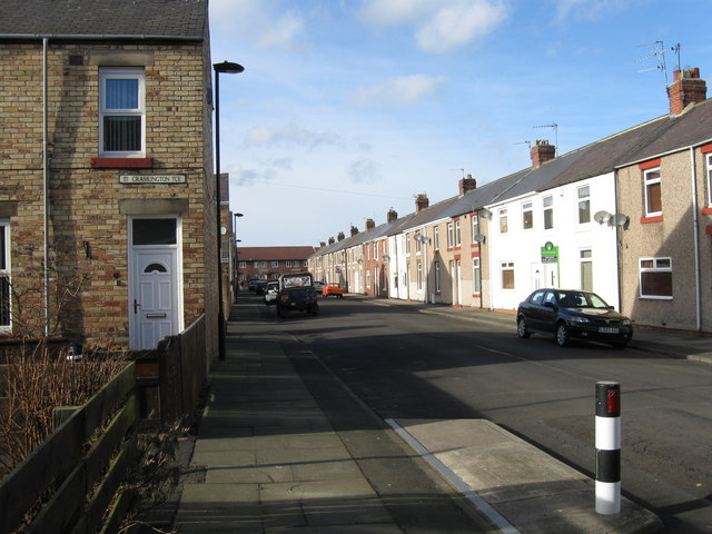
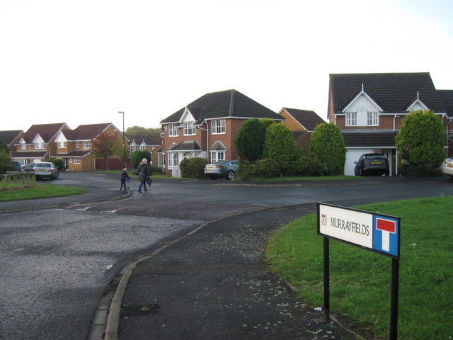
West Allotment used to comprise only one housing estate, known to the locals as 'The Allotment', However, in the late 1990s two new estates were constructed, Murrayfields and Holyfields; Holyfields is the larger of the two. Brookfield and Cloverfield are both classed as Holyfields although they are both detached from the original Holyfields estate. Brookfield and Cloverfield are linked together and Cloverfield is nearing completion.
Subsidence
A number of properties in the area were found to have subsidence damage early in 2016. Investigations by the Coal Authority to find out the cause of the ground movement concluded that the surface damage at Bayfield was probably as a result of historical coal mining. It was found necessary to demolish some properties, with compensation to the residents.
Visit the page: West Allotment for references and further details. You can contribute to this article on Wikipedia.
from Flickr (flickr)
AB012b_J27 65842 ex works, at West Allotment heading for Percy Main Jan1963
Pinned by Simon Cotterill

from http://www.twsitelines.info/S…
Tyne and Wear HER(15454): West Allotment, Hope Pit
- Shown on the Shiremoor Enclosure Map of 1790.
Added by
Simon Cotterill
from IllustratedChronicles (flickr)
J Carlyle - RE - West Allotments (Killed)
Pinned by Simon Cotterill
from IllustratedChronicles (flickr)
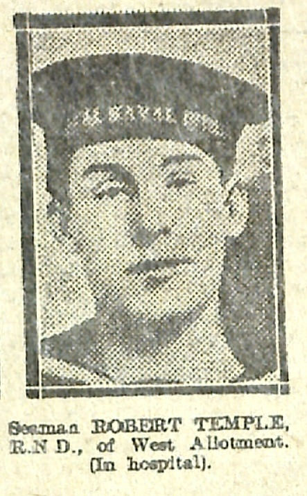
Robert Temple - RND - West Allotment (In hospital)
Pinned by Simon Cotterill


from Flickr (flickr)
Pte. Jas Robson - Northumberland Fusiliers - West Allotment
Pinned by Simon Cotterill
from Geograph (geograph)
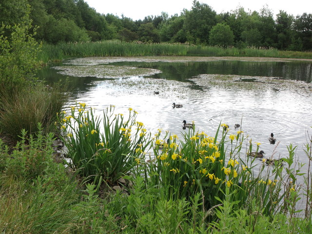
West Allotment Pond near Silverlink Biodiversity Park
Pinned by Simon Cotterill
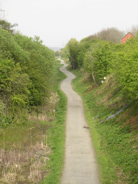
from Geograph (geograph)
Cycle route in former railway cutting, West Allotment
Pinned by Simon Cotterill
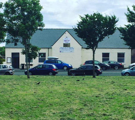
from https://www.westallotmentcomm…
West Allotment Community Centre
- Official Website of West Allotment Community Centre...."West Allotment Community Centre is a registered charity ran entirely by volunteers...."
Added by
Simon Cotterill

from https://johnsmancave.org/
West Allotment Local History
- ....“The Allotment” was not called after garden plots. It has nothing at all to do with garden allotments. The name stems from the Enclosures Act 1790 Moor Enclosure in which …
Added by
Simon Cotterill
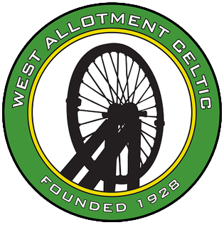
from https://westallotmentcelticfc…
West Allotment Celtic Football Club
- Official Website of the club....
Added by
Simon Cotterill

from https://historicengland.org.u…
War Memorial - West Allotment - List Entry
- ...II War memorial. Circa 1919. Granite and marble. Two steps to square pedestal, with plinth and cornice, supporting figure of angel holding flag in left arm and laurel wreath in …
Added by
Simon Cotterill
from https://sitelines.newcastle.g…
Backworth Colliery, Algernon Pit
- Shown on the 2nd edition OS mapping with an Aqueduct and two reservoirs. This was opened in c 1820. This had originally been a pumping shaft belonging to the Shiremoor …
Added by
Simon Cotterill

from https://www.twsitelines.info/…
Allotment Mill
- Site of the Backworth Colliery granary and feed preparation mill for pit pony fodder. The granary appears to have been built and incorporated into the Allotment Farm (HER 19175), which …
Added by
Simon Cotterill
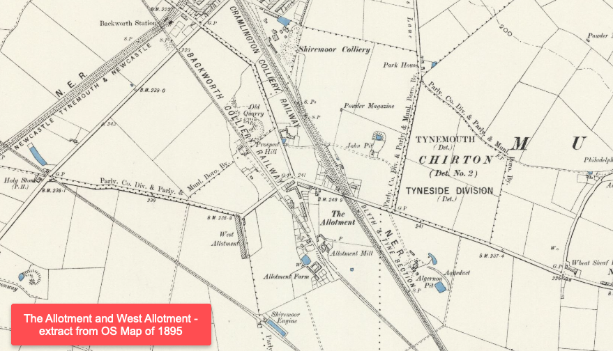
from https://maps.nls.uk/view/1010…
Map of The Allotment and West Allotment, 1895
- Extract from OS Map (Northumberland Sheet LXXXIX.NW) Revised: 1894 to 1895, Published: 1898. CC.BY (NLS)
Added by
Simon Cotterill

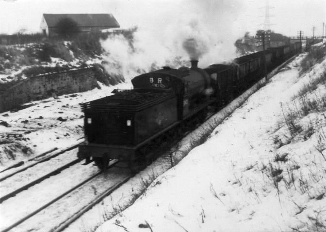
from Flickr (flickr)
AB012b_J27 65842 ex works, at West Allotment heading for Percy Main Jan1963
Pinned by Simon Cotterill
from http://www.twsitelines.info/S…
Tyne and Wear HER(15454): West Allotment, Hope Pit
- Shown on the Shiremoor Enclosure Map of 1790.
Added by
Simon Cotterill
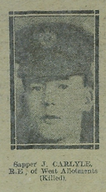
from IllustratedChronicles (flickr)
J Carlyle - RE - West Allotments (Killed)
Pinned by Simon Cotterill
from IllustratedChronicles (flickr)
Robert Temple - RND - West Allotment (In hospital)
Pinned by Simon Cotterill
from Flickr (flickr)
Pte. Jas Robson - Northumberland Fusiliers - West Allotment
Pinned by Simon Cotterill
from Geograph (geograph)
West Allotment Pond near Silverlink Biodiversity Park
Pinned by Simon Cotterill
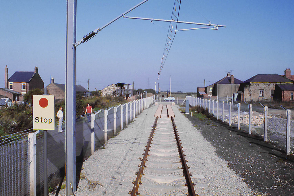
from Geograph (geograph)
Cycle route in former railway cutting, West Allotment
Pinned by Simon Cotterill
from https://www.westallotmentcomm…
West Allotment Community Centre
- Official Website of West Allotment Community Centre...."West Allotment Community Centre is a registered charity ran entirely by volunteers...."
Added by
Simon Cotterill
from https://johnsmancave.org/
West Allotment Local History
- ....“The Allotment” was not called after garden plots. It has nothing at all to do with garden allotments. The name stems from the Enclosures Act 1790 Moor Enclosure in which …
Added by
Simon Cotterill
from https://westallotmentcelticfc…
West Allotment Celtic Football Club
- Official Website of the club....
Added by
Simon Cotterill
from https://historicengland.org.u…
War Memorial - West Allotment - List Entry
- ...II War memorial. Circa 1919. Granite and marble. Two steps to square pedestal, with plinth and cornice, supporting figure of angel holding flag in left arm and laurel wreath in …
Added by
Simon Cotterill
from https://sitelines.newcastle.g…
Backworth Colliery, Algernon Pit
- Shown on the 2nd edition OS mapping with an Aqueduct and two reservoirs. This was opened in c 1820. This had originally been a pumping shaft belonging to the Shiremoor …
Added by
Simon Cotterill
from https://www.twsitelines.info/…
Allotment Mill
- Site of the Backworth Colliery granary and feed preparation mill for pit pony fodder. The granary appears to have been built and incorporated into the Allotment Farm (HER 19175), which …
Added by
Simon Cotterill
from https://maps.nls.uk/view/1010…
Map of The Allotment and West Allotment, 1895
- Extract from OS Map (Northumberland Sheet LXXXIX.NW) Revised: 1894 to 1895, Published: 1898. CC.BY (NLS)
Added by
Simon Cotterill


