Topics > Northumberland > Turney Shield, West Allen
Turney Shield, West Allen
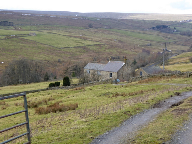
Low Turney Shield and High Turney Shield are farms are located by the River West Allen, north of where Turney Cleugh joins the river. The farmhouse and outbuilding at Low Turney Shield date from the late 17th or early 18th century and are Grade II listed on the National Heritage List of England.[1] A lead mine was recorded at Turney Shield.[2] Historically, Turney Shield was part of the grieveship of High West Allen in the ancient parish of Allendale. Today, Turney Shield is part of West Allen Civil Parish.

from https://historicengland.org.u…
LOW TURNEY SHIELD FARMHOUSE AND ADJACENT OUTBUILDINGS - West Allen - List Entry
- Farmhouse and outbuilding. Late C17 or early C18, perhaps incorporating earlier fabric, restored 1976. Rubble with stone slate roof. House 2 storeys, 3 bays......Rear elevation; house outshut has 3 small …
Added by
Simon Cotterill

from https://keystothepast.info/se…
Turney Shield Mine (West Allen)
- ...Coombes records a lead mine at Turney Shield.....
Added by
Simon Cotterill

from https://historicengland.org.u…
LOW TURNEY SHIELD FARMHOUSE AND ADJACENT OUTBUILDINGS - West Allen - List Entry
- Farmhouse and outbuilding. Late C17 or early C18, perhaps incorporating earlier fabric, restored 1976. Rubble with stone slate roof. House 2 storeys, 3 bays......Rear elevation; house outshut has 3 small …
Added by
Simon Cotterill
from https://keystothepast.info/se…
Turney Shield Mine (West Allen)
- ...Coombes records a lead mine at Turney Shield.....
Added by
Simon Cotterill


