Elsdon Village

-
Description
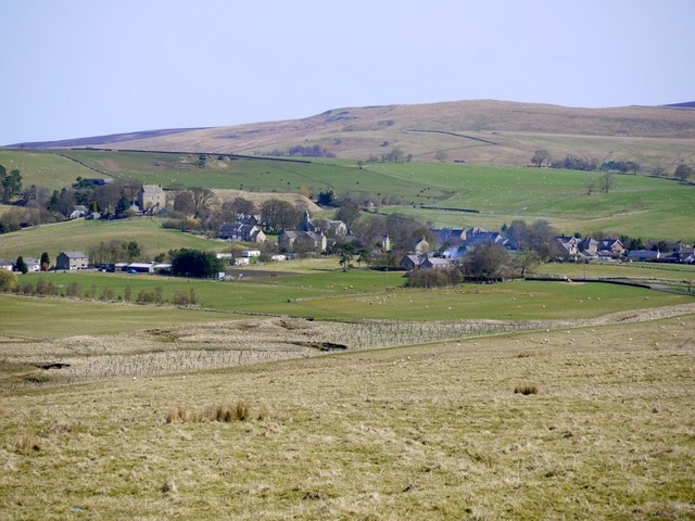
"View approaching the village on the road from Raylees. Very similar view to that posted by Peter McDermott from a nearby hill [[1548982]]. Elsdon Tower can be seen on the left, the church and pub almost central, with the castle mound behind. The road junction just north of Elsdon Bridge is on the far right. Behind the village, the hills rise towards Darden Pike. The Rev. Dodgson, rector of Elsdon between 1762 and 1765, wrote the following description: "The situation of the village is such that in descending a hill called Gallawlaw, from the south, it gives a person an idea of a few scattered cottages built in a boggy island, which is almost surrounded by three little brooks..." http://www.northumberlandnationalpark.org.uk/__data/assets/pdf_file/0008/147851/elsdonvillageatlas.pdf" Photo by Andrew Curtis, 2010. -
Owner
Andrew Curtis -
Source
Geograph (Geograph) -
License
What does this mean? Creative Commons License
-
Further information
Link: http://www.geograph.org.uk/photo/1809635
Resource type: Image
Added by: Simon Cotterill
Last modified: 7 years, 3 months ago
Viewed: 737 times
Picture Taken: 2010-04-16 -
Co-Curate tags


