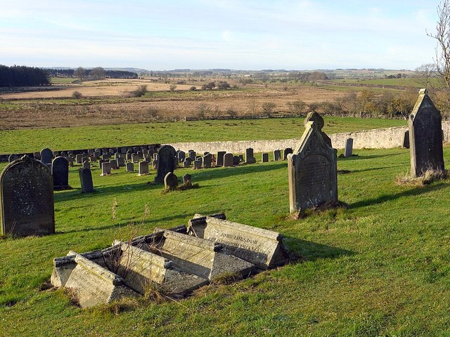
Graveyard west of St Mary's Church, Stamfordham

-
Description
"Beyond the graveyard wall is the flat land around the River Pont and How Burn, formerly a large lake before agricultural drainage partially reclaimed the land." Photo by Andrew Curtis, 2012. -
Owner
Andrew Curtis -
Source
Geograph (Geograph) -
License
What does this mean? Creative Commons License
-
Further information
Link: http://www.geograph.org.uk/photo/2783433
Resource type: Image
Added by: Simon Cotterill
Last modified: 7 years, 5 months ago
Viewed: 651 times
Picture Taken: 2012-01-28 -
Co-Curate tags

")

