Terraced houses in Dunsdale

Related Pages


Dunsdale


Tees Valley

  • Description

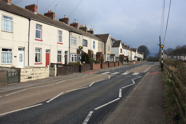
    "This photograph shows a view of some of the terraced houses that line the eastern side of the B1269 road as it passes through the village of Dunsdale. The picture was taken from near the bus stop looking in a south-south-easterly direction towards Carling Howe Farm." Photo by Philip Barker, 2010.
  • Owner

    Philip Barker
  • Source

    Geograph (Geograph)
  • License

    What does this mean? Creative Commons License
  • Further information

    Link: http://www.geograph.org.uk/photo/1782968
    Resource type: Image
    Added by: Splat
    Last modified: 5 years, 8 months ago
    Viewed: 412 times
    Picture Taken: 2010-04-02
  • Co-Curate tags

Comments

Add a comment or share a memory.

Login to add a comment. Sign-up if you don't already have an account.

ABOUT US

Co-Curate is a project which brings together online collections, museums, universities, schools and community groups to make and re-make stories and images from North East England and Cumbria. Co-Curate is a trans-disciplinary project that will open up 'official' museum and 'un-officia'l co-created community-based collections and archives through innovative collaborative approaches using social media and open archives/data.

LATEST SHARED RESOURCES