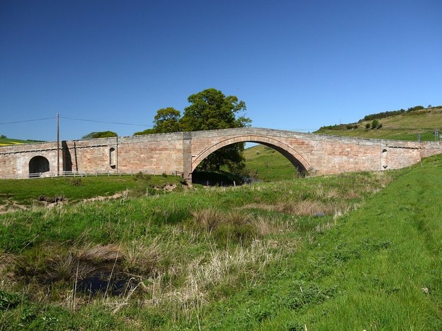
Weetwood Bridge

-
Description
"In the foreground are a few of the small ponds on the south bank of the River Till, between the river and the flood defence bank on which the photo was taken. 14 are shown on the 1924 1:2500 OS map but for what purpose they were dug is unknown, although possibly part of flood defences [[2962295]] Similar 'leaky' ponds have been recently created on other water-courses in Northumberland, to store water during flood conditions, and gradually release it through pipes when the flood danger has passed." Photo by Andrew Curtis, 2012. -
Owner
Andrew Curtis -
Source
Geograph (Geograph) -
License
What does this mean? Creative Commons License
-
Further information
Link: http://www.geograph.org.uk/photo/2962258
Resource type: Image
Added by: Simon Cotterill
Last modified: 7 years, 10 months ago
Viewed: 802 times
Picture Taken: 2012-05-25 -
Co-Curate tags


