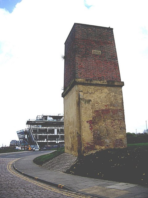
A red-brick tower at Mill Dam, dating from 1865

-
Description
"A viewer has pointed out that this area was once the site of a glassworks, and the structure is described as a chimney on some maps. To quote him "The first Ordnance Survey (OS) map of the area in 1862 shows a large crane, landing stage, dock and the Subscription Brewery complex. The massive Swinburne Glassworks sat on what is now open grass to the north of the area, only the chimney base remaining today and now lowered in height"." Photo by Stanley Howe, 2011. -
Owner
Stanley Howe -
Source
Geograph (Geograph) -
License
What does this mean? Creative Commons License
-
Further information
Link: http://www.geograph.org.uk/photo/2367324
Resource type: Image
Added by: Simon Cotterill
Last modified: 8 years, 2 months ago
Viewed: 983 times
Picture Taken: 2011-04-16 -
Co-Curate tags


