No man's land


-
Description
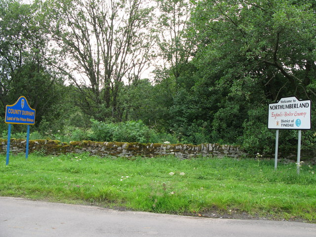
"So where exactly am I??? The following information supplied by Keith Cunningham:- The picture shows the boundary between County Durham and Northumberland. The Derwent used to meander around the area and the Ordnance Survey chose this point as the Border when they produced their first map in about 1860. Since then the river has changed its course and a bridge has been built. Hence "Baybridge"." Photo by Mike Quinn, 2007. -
Owner
Mike Quinn -
Source
Geograph (Geograph) -
License
What does this mean? Creative Commons License
-
Further information
Link: http://www.geograph.org.uk/photo/513950
Resource type: Image
Added by: Simon Cotterill
Last modified: 8 years, 6 months ago
Viewed: 770 times
Picture Taken: 2007-07-25 -
Co-Curate tags


