North of Longstone and Northern Hares

-
Description
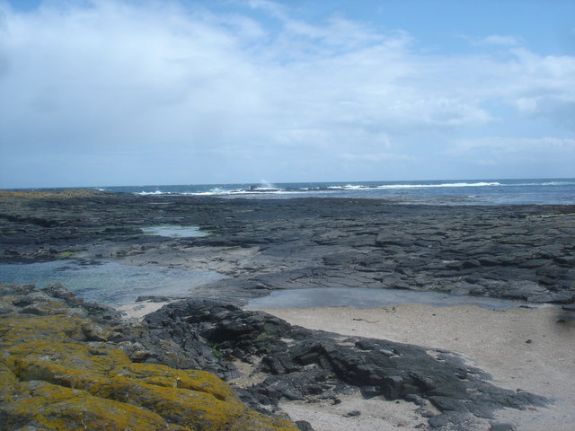
"Longstone Island at low tide is bigger by a factor of at least five than the extent at high tide of Northern Hares, Longstone and other rocks which remain above water as separate small islands (the highest only 7m asl). The parts which are covered are mostly flat wave-cut rock platforms like this one to the NE of the lighthouse. The reef extending NE towards the right of the photo continues underwater to Knivestone a kilometre further out to sea, and can cause breaking waves and severe overfalls as the tide rushes over it." Photo by Andy Waddington, 2008. -
Owner
Andy Waddington -
Source
Geograph (Geograph) -
License
What does this mean? Creative Commons License
-
Further information
Link: http://www.geograph.org.uk/photo/1219266
Resource type: Image
Added by: Simon Cotterill
Last modified: 9 years, 2 months ago
Viewed: 695 times
Picture Taken: 2008-05-18 -
Co-Curate tags


