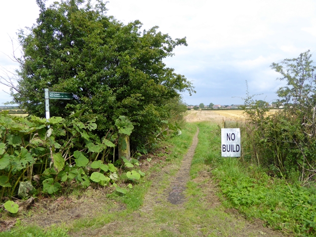
Footpath from Murton to West Monkseaton


-
Description
"Murton Gap is an area of approximately 400 hectares of farmland surrounding Murton village. The area is almost entirely surrounded by built-up areas of North Tyneside. Plans to build up to 3,000 houses on this area of green belt are being vigorously opposed." Photo by Oliver Dixon, 2016, and licensed for reuse under a Creative Commons Licence. -
Owner
Geograph.org.uk -
Source
Geograph (Geograph) -
License
What does this mean? Attribution-ShareAlike 2.0 Generic (CC BY-SA 2.0)
-
Further information
Link: http://www.geograph.org.uk/photo/5064802
Resource type: Text/Website
Added by: Simon Cotterill
Last modified: 9 years, 6 months ago
Viewed: 1127 times
Picture Taken: Unknown -
Co-Curate tags


