Wall Mile 27

-
Description
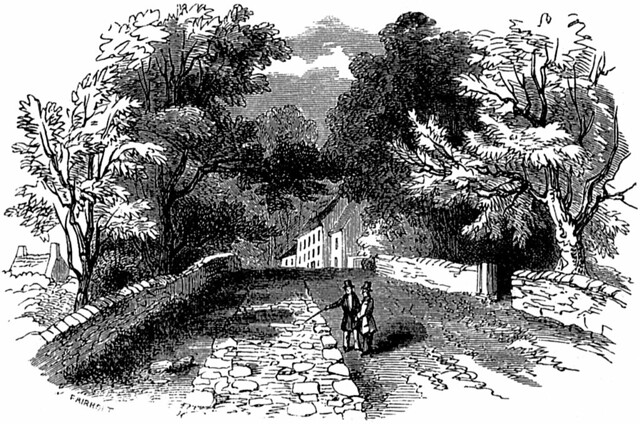
Woodcut (by F.W. Fairholt) depicting the curtain wall showing through the surface of the Military Road at Walwick, just east of Milecastle 28 (Walwick), looking NW. This was still visible at the beginning of the 20th century when Maria A. Hoyer wrote 'at this point, part of the foundation becomes visible. It gave one a thrill to look at those venerable stones; surely they merited a salute, a genuflection! The road here mounts up steeply, and the rush of the rainwater probably keeps the stones bare.' (http://www.openlibrary.org/details/byromanwallnotes00hoyeuoft" >By the Roman Wall, London, 1908). Scanned from the 1921 8th edition of the Handbook to the Roman Wall. Handbook p.210. -
Owner
The Armatura Press -
Source
Flickr (Flickr) -
License
What does this mean? Public Domain Mark
-
Further information
Link: https://www.flickr.com/photos/83154955@N00/179780696/
Resource type: Image
Added by: Simon Cotterill
Last modified: 9 years ago
Viewed: 876 times
Picture Taken: Unknown -
Co-Curate tags


