Burradon village


-
Description
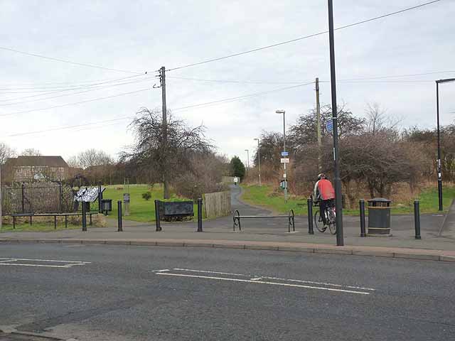
"A crossing of Burradon Road, B1505 near the centre of Burradon. To the left is Fryers Millennium Green, a urban renewal scheme which was approved by the Countryside Commission as a Millennium Green and was opened in 2001. Straight ahead is the line of the Burradon and Holywell Waggonway. This was one of many waggonways LinkExternal link linking former coalmines in North Tyneside with the coal staithes on the Tyne. Along with many other lengths of waggonway, this section has been converted into a cycle path in recent years and this section forms part of National Cycle Network, Regional Route 10 (the Reivers Cycle Route) LinkExternal link which links Tynemouth with Whitehaven via Kielder Forest and Carlisle. Ironwork street furniture, such as the barrier, is a common feature found on the restored paths." Photo by Oliver Dixon, 2012, and licensed for reuse under a Creative Commons Licence. -
Owner
Geograph.org.uk -
Source
Geograph (Geograph) -
License
What does this mean? Attribution-ShareAlike 2.0 Generic (CC BY-SA 2.0)
-
Further information
Link: http://www.geograph.org.uk/photo/2817782
Resource type: Text/Website
Added by: Simon Cotterill
Last modified: 9 years, 7 months ago
Viewed: 1175 times
Picture Taken: Unknown -
Co-Curate tags


