Wall Mile 6


-
Description
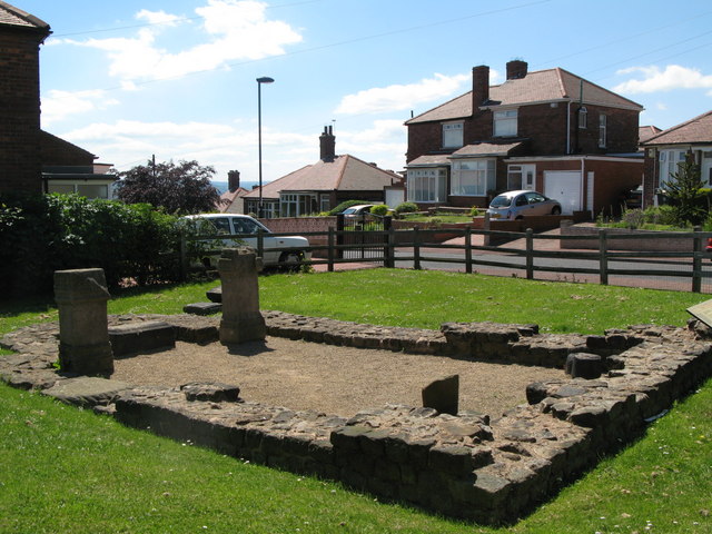
Temple of Antenociticus in the civil settlement (vicus) of the fort at Benwell. This is http://maps.google.co.uk/?ie=UTF8&om=1&z=19&ll=54.976194,-1.662353&spn=0.000627,0.001794&t=k" >visible on the satellite imagery used by Google Maps. Looking NW. Handbook pp.155–7. -
Owner
The Armatura Press -
Source
Flickr (Flickr) -
License
What does this mean? Attribution-NonCommercial-ShareAlike License
-
Further information
Link: https://www.flickr.com/photos/83154955@N00/177773195/
Resource type: Image
Added by: Simon Cotterill
Last modified: 9 years, 2 months ago
Viewed: 1127 times
Picture Taken: Unknown -
Co-Curate tags


