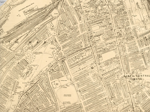
Gateshead, OS 1919 (bottom)


-
Description
Bottom half of Ordnance Survey map of Central Newcastle Upon Tyne and Gateshead, 1919. Crown copyright in this map (first published in 1920) expired in 1970 and now has unrestricted Creative Commons status - available for reuse by any person, in any way (including re-editing), in any context and without restrictions of any kind. -
Owner
Victoria Sage -
Source
Victoria Sage (Flickr) -
License
What does this mean? Attribution License
-
Further information
Link: https://www.flickr.com/photos/74726036@N04/7346428414/
Resource type: Image
Last modified: 11 years, 6 months ago
Viewed: 1414 times
Picture Taken: Unknown -
Co-Curate tags


