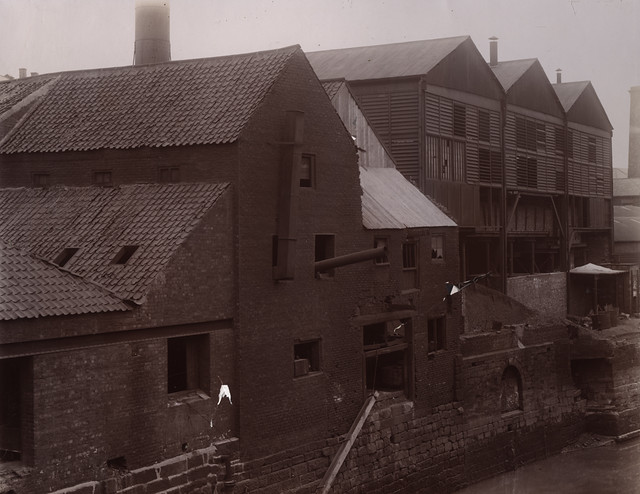
034789:Ouseburn Road Area, Byker, Newcastle upon Tyne, Dept of Environmental Health c.1935


-
Description
Type : Photograph Medium : Print-black-and-white Description : A view of the Ouseburn Road Area Byker taken in c.1935. The view has been taken from Stepney Road looking east and shows Ouseburn Road Crawford's Row Appleton's Buildings Porter's Hill and Hannington Place. The Ouseburn railway viaduct can be seen to the left and the shadow of Byker Bridge to the right. The bridge in the foreground to the left led to Ouseburn Lead Works. Collection : Local Studies Printed Copy : If you would like a printed copy of this image please contact Newcastle Libraries www.newcastle.gov.uk/tlt quoting Accession Number : 034789 -
Owner
Newcastle Libraries -
Source
Newcastle libraries (Flickr) -
License
What does this mean? Public Domain Mark
-
Further information
Link: https://www.flickr.com/photos/39821974@N06/4080243065/
Resource type: Image
Last modified: 9 years, 2 months ago
Viewed: 1871 times
Picture Taken: Unknown -
Co-Curate tags
")

