Old Boundary Marker on Drover Hole Hill


-
Description
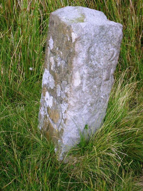
"Estate Boundary Marker on Drover Hole Hill near to The Long Causeway to Tan Hill. On the boundary of Kaber parish, Westmorland, now Cumbria; Bowes parish, North Riding, now Durham and Muker parish, North Riding, now North Yorkshire. Inscribed 1912 / L H and L O on opposite faces. Grade II Listed details https://historicengland.org.uk/listing/the-list/list-entry/1327013. See also https://www.lakesguides.co.uk/photos/BRZ90.jpg and https://www.lakesguides.co.uk/photos/CAI33.jpg. Milestone Society National ID: WE_CBDM153em" Photo by Colin Smith, 2014. -
Owner
Colin Smith -
Source
Geograph (Geograph) -
License
What does this mean? Creative Commons License
-
Further information
Link: http://www.geograph.org.uk/photo/7625960
Resource type: Image
Added by: Simon Cotterill
Last modified: 2 months, 1 week ago
Viewed: 82 times
Picture Taken: 2014-07-31 -
Co-Curate tags
