Tramway (Bardon Mill)


-
Description
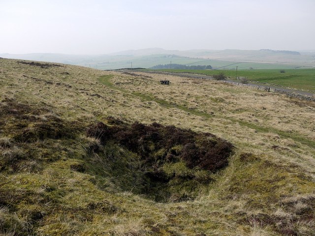
A post medieval tramway is visible as earthworks on air photographs, centred at NY 7744 6506 . It lies to the south of Westwood cottages. Only a short section 130 metres in length is visible on air photographs. The first edition Ordnance Survey map shows a much more extensive tramway system, but much of its length is masked by trees on air photos, as it runs along the banks of Chainley Burn. This section runs between Barcombe Colliery and other coal mine adits and also past quarries, then south towards Bardon MIll, terminating at a lime kiln. It may have been used for transporting limestone, sandstone, coal or clay..... -
Owner
Keys to the Past (Durham & Northumbria County Councils) -
Source
Local (Co-Curate) -
License
What does this mean? Unknown license check permission to reuse
-
Further information
Link: https://keystothepast.info/search-records/results-of-search/results-of-search-2/site-details/?PRN=N33177
Resource type: Text/Website
Added by: Simon Cotterill
Last modified: 2 months, 3 weeks ago
Viewed: 98 times
Picture Taken: Unknown -
Co-Curate tags

