Towne Gate, Heddon on the Wall


-
Description
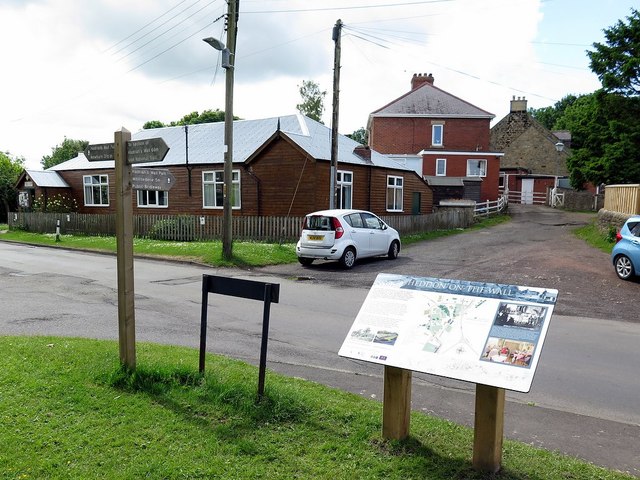
"The location shown is where Hadrian's Wall Path (National Trail) going from east to west turns from Towne Gate, the road through the village, onto the path of Chare Bank (ahead) which follows part of the ditch line of the Roman Vallum. The finger post on the left points out the trail direction as well as a short detour (right) towards the preserved section of the Roman Wall on the east side of Heddon village. The route of the trail through the village has recently (2017) been augmented by three large information boards which show a suitably oriented map and some historical information. The board here points out the Roman Wall and the Women's Institute which was the first in Northumberland, founded in 1917. Their hut 9opposite) was built in 1922 [[4511761]]" Photo by Andrew Curtis, 2017. -
Owner
Andrew Curtis -
Source
Geograph (Geograph) -
License
What does this mean? Creative Commons License
-
Further information
Link: http://www.geograph.org.uk/photo/5422724
Resource type: Image
Added by: Simon Cotterill
Last modified: 3 months ago
Viewed: 73 times
Picture Taken: 2017-06-09 -
Co-Curate tags


