Hadrian's Wall and vallum and their associated features between Poltross Burn and the River Irthing in wall mile 48 - List Entry


-
Description
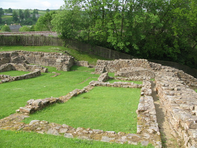
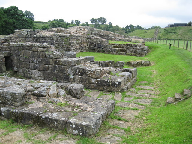
....The monument includes the section of Hadrian's Wall and vallum and their associated features between the Poltross Burn in the east and the River Irthing in the west. Hadrian's Wall survives as an upstanding feature throughout most of this section. All the upstanding sections of Wall are consolidated and in the care of the Secretary of State. The upstanding stretch of Wall from the railway embankment to Roman Way is also Listed Grade I. The Wall here is of narrow wall type, 2.2m wide, set on broad wall foundation, 3m wide. It stands to a maximum height of 2.8m west of turret 48b, but elsewhere averages 1.4m high. The wall ditch also survives well as a feature visible on the ground in this section.....The foundations of the bridge abutment which carried Hadrian's Wall over the River Irthing are exposed on the east bank. It survives as a large upstanding stone feature.... -
Owner
Historic England -
Source
Local (Co-Curate) -
License
What does this mean? Unknown license check permission to reuse
-
Further information
Link: https://historicengland.org.uk/listing/the-list/list-entry/1015923
Resource type: Text/Website
Added by: Simon Cotterill
Last modified: 3 months, 1 week ago
Viewed: 115 times
Picture Taken: Unknown -
Co-Curate tags

")
