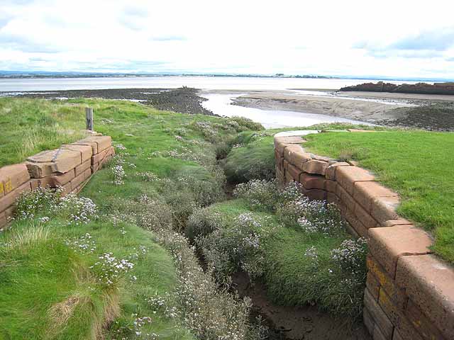
Wall Mile 78


-
Description
The point south-east of Port Carlisle where the National Trail (on the left) joins the course of the old railway line and canal (to the right) and the Wall, mid-way between Turret 78A and 78B. Looking SW Handbook p.363 -
Owner
The Armatura Press -
Source
Flickr (Flickr) -
License
What does this mean? CC BY-SA 2.0
-
Further information
Link: https://www.flickr.com/photos/83154955@N00/5849845113/
Resource type: Image
Added by: Simon Cotterill
Last modified: 3 months, 1 week ago
Viewed: 73 times
Picture Taken: 2011-05-19T11:15:15 -
Co-Curate tags


")