Hawcoat Hill


-
Description
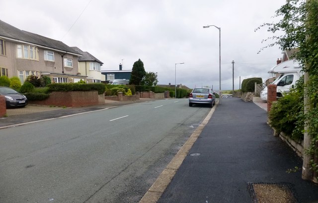
"I got out the car to bag the summit. Name: Hawcoat Hill Hill number: 16321 Height: 84m / 276ft Parent (Ma/M): 2668 Kirkby Moor [Lowick High Common] Section: 34D: Southern Cumbria County/UA: Cumbria (CoU) Class: Tump (0-99m) Grid ref: SD 20394 72241 Summit feature: pavement outside 62 Rakesmoor Lane Drop: 61m Col: 23m SD216748 Observations: high point in Kepplewray Drive is lower Survey: Abney level" Photo by Rude Health , 2014. -
Owner
Rude Health -
Source
Geograph (Geograph) -
License
What does this mean? Creative Commons License
-
Further information
Link: http://www.geograph.org.uk/photo/4600020
Resource type: Image
Added by: Simon Cotterill
Last modified: 4 months ago
Viewed: 68 times
Picture Taken: 2014-08-13 -
Co-Curate tags
