Crosshill Stone, Grains o' th' Beck

-
Description
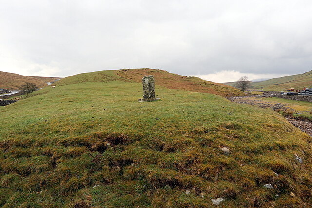
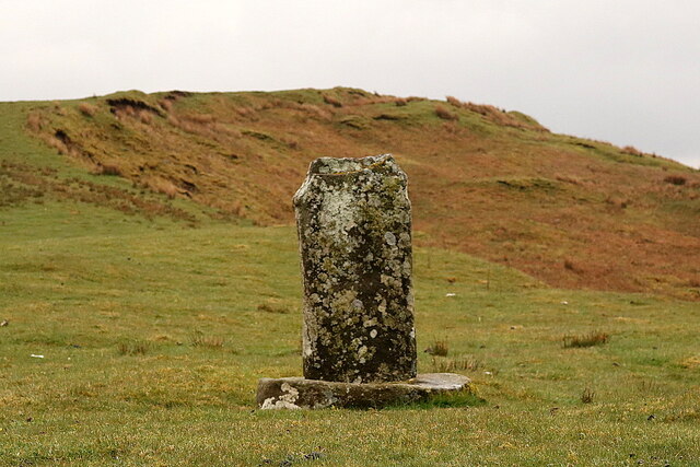
"See description here [[1745531]] Medieval base of a wayside cross and probably later slab. Limestone. Thin, 1.25-metre tall limestone slab tenoned into a rough oval base with worn rectangular socket hole. Wayside crosses are one of several types of Christian cross erected during the medieval period, mostly from the 9th to 15th centuries AD. In addition to serving the function of reiterating and reinforcing the Christian faith amongst those who passed the cross and of reassuring the traveller, wayside crosses often fulfilled a role as waymarkers, especially in difficult and otherwise unmarked terrain. The crosses might be on regularly used routes linking ordinary settlements or on routes having a more specifically religious function, including those providing access to religious sites for parishioners and funeral processions, or marking long-distance routes frequented on pilgrimages. The Crosshill Stone is situated on a ridge 60m south of the farm buildings at Grains o' th' Beck and beside the crossing of Arngill Beck on the route between Brough and Middleton-in-Teesdale. It is the only known survivor of the wayside crosses marked for this route on John Speed's map of 1610. The other sites were Laithkirk, Kelton and Stackholm. The Crosshill Stone is a Grade II Scheduled Monument (List Entry Number: 1017014): https://historicengland.org.uk/listing/the-list/list-entry/1017014" Photo by Andrew Curtis, 2021. -
Owner
Andrew Curtis -
Source
Geograph (Geograph) -
License
What does this mean? Creative Commons License
-
Further information
Link: http://www.geograph.org.uk/photo/6821977
Resource type: Image
Added by: Simon Cotterill
Last modified: 1 year, 1 month ago
Viewed: 250 times
Picture Taken: 2021-04-28 -
Co-Curate tags


