Force Beck


-
Description
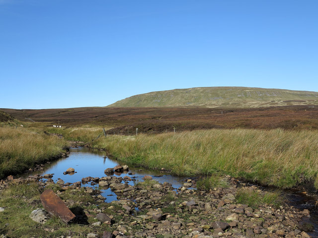
"Force Beck is one of many tributary streams of Connypot Beck. The location is the moorland to the south of Mickle Fell which is the distant mountain. The brown stone to the bottom left of the image is numbered 69 and is one of a series of many such stones which marked the old county boundary between Cumberland and Yorkshire - now Cumbria and County Durham. Most of these stones are still in place though some are missing - it's suspected that some have simply sunk into the peat bogs which are so common - the brown colouration of No. 69 could well be due a lengthy immersion in peat. That it now lies in the stream bed of Force Beck would be due to the erosion of peat by the stream liberating it." Photo by Trevor Littlewood, 2012. -
Owner
Trevor Littlewood -
Source
Geograph (Geograph) -
License
What does this mean? Creative Commons License
-
Further information
Link: http://www.geograph.org.uk/photo/3169221
Resource type: Image
Added by: Simon Cotterill
Last modified: 1 year ago
Viewed: 188 times
Picture Taken: 2012-10-07 -
Co-Curate tags

