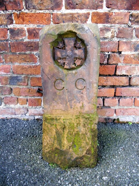
Old Boundary Marker on Richardson Street, Carlisle

-
Description
"Municipal Boundary Marker set against the brick wall of a building in the northeast corner of the cemetery, visible from the road in the front garden of No.151 on the south side of Richardson Street, Carlisle. This became the boundary of Cummersdale and Caldewgate parishes in 1894 when the part of Cummersdale in Carlisle municipal borough was transferred to Caldewgate. Entirely in Carlisle from 1912. Milestone Society National ID: CU_CL08pb" Photo by Colin Smith, 2016. -
Owner
Colin Smith -
Source
Geograph (Geograph) -
License
What does this mean? Creative Commons License
-
Further information
Link: http://www.geograph.org.uk/photo/7572110
Resource type: Image
Added by: Simon Cotterill
Last modified: 1 year ago
Viewed: 207 times
Picture Taken: 2016-04-14 -
Co-Curate tags


