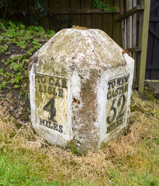
Old Milestone by the former A689 in Low Crosby Bridge

-
Description
"Metal plate attached to stone post by the UC road (was A689), in parish of STANWIX RURAL (CARLISLE District), Low Crosby, opposite parish hall, on loop of road now by-passed, on a wide grass verge beside a garden gate, on South side of road. Military Road plate, erected by the Carlisle & Temon (Military Road) turnpike trust in the 19th century. Inscription reads:- : TO CAR / LISLE / 4 / MILES : : TO NEW / CASTLE / 52 / MILES : Grade II Listed. List Entry Number: 1087738 https://historicengland.org.uk/listing/the-list/list-entry/1087738 Milestone Society National ID: CU_CLNC04." Photo by CF Smith, 2004. -
Owner
CF Smith -
Source
Geograph (Geograph) -
License
What does this mean? Creative Commons License
-
Further information
Link: http://www.geograph.org.uk/photo/5623007
Resource type: Image
Added by: Simon Cotterill
Last modified: 1 year, 2 months ago
Viewed: 233 times
Picture Taken: 2004-07-04 -
Co-Curate tags


