Erased benchmark on side of Sedbergh 2 milestone


-
Description
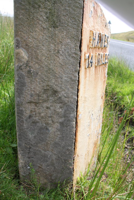
"The marks seen on the side of this milestone beside the A684 may be the remains of the Ordnance Survey benchmark levelled at 518.198 feet above Liverpool Datum during the 1845 Kirkby Kendal to Thirsk 1GL Survey. The surveyor's description was 'No. 37. Mark on the 2d milestone from Sedbergh and 14th from Hawes ; 0.66 ft. above centre of road'. It is shown on the 1888-1913 6" Map as BM 527.5 so was evidently moved after the 1GL Survey, and a new benchmark was later (1953?) levelled on its top [[3575426]]. See http://www.bench-marks.org.uk/bm24844" Photo by Roger Templeman, 2013. -
Owner
Roger Templeman -
Source
Geograph (Geograph) -
License
What does this mean? Creative Commons License
-
Further information
Link: http://www.geograph.org.uk/photo/3575513
Resource type: Image
Added by: Simon Cotterill
Last modified: 1 year, 3 months ago
Viewed: 173 times
Picture Taken: 2013-07-17 -
Co-Curate tags


