Old Boundary Marker

-
Description
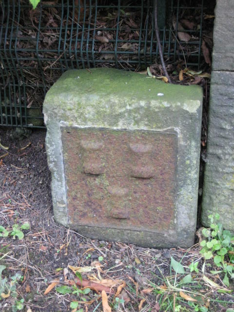
"Estate Boundary Marker beside the left-hand gate pier of Millmount, on the south side of Ponteland Road, Newcastle upon Tyne. The arms of Newcastle are displayed in low relief on its face. After a dispute in 1770 between the Freemen and the Corporation of Newcastle the boundary of the Town Moor was marked. Grade II Listed https://historicengland.org.uk/listing/the-list/list-entry/1106311. Milestone Society National ID: NB_NEWC02em" Photo by Mike Rayner, 2019. -
Owner
Mike Rayner -
Source
Geograph (Geograph) -
License
What does this mean? Creative Commons License
-
Further information
Link: http://www.geograph.org.uk/photo/6456617
Resource type: Image
Added by: Simon Cotterill
Last modified: 1 year, 3 months ago
Viewed: 267 times
Picture Taken: 2019-08-16 -
Co-Curate tags


